Big Slide (plus bonus material)!

CAMP
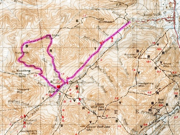
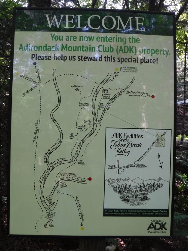
(Outdated) map courtesy of the Adirondack Mountain Club.
THE GARDEN
TRAILHEAD

August 2017
BIG SLIDE SUMMIT

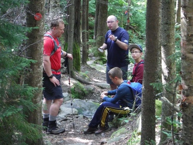
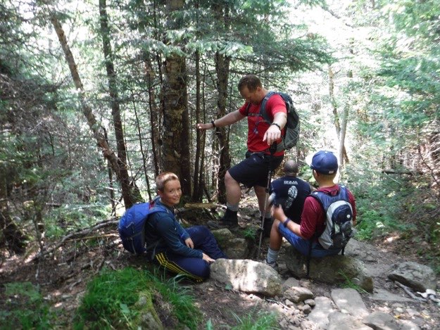
Having done Big Slide twice, (once for my 46er quest in the fall, and once in the winter to help friends check it off their list), we were looking for a cool trip to take our oldest boys on, that wasn’t too much of a tough journey. We chose to tackle Big Slide as a longer 3-day weekend, to get our boys some experience with a backpacking trip.
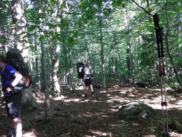
On Friday, after an early lunch at the famous Noonmark Diner, we parked at the Garden parking lot in Keene Valley, then hiked in 3.5 miles to the Johns Brook Lodge (JBL), and set up camp at the tent sites located just beyond the Lodge. It’s a place we were very familiar with, and comfortable with. The close proximity to the Lodge and the potable water spigot there was perfect for this kind of trip.
Note: we had initially planned on camping right off the red Big Slide Trail shown on our map, but after much searching, found that the map must be outdated, and those campsites are no longer used. No big deal; because like I said, we just went to our default tent sites beyond the lodge, and it worked out probably for the better anyway!
So after a very chilly night (37 degrees F), we hiked up the Big Slide trail, summited Big Slide, then continued on to Yard Mountain, and then down to the Klondike Notch trail, and back to Johns Brook Lodge in a counter-clockwise loop. Total mileage that day was 6.6 miles from JBL, and here’s how it broke down:
from JBL to the left turn onto the Big Slide Brook trail, 0.3 miles. From there to the summit of Big Slide was 2.3 miles. From there to Yard Mountain was 1.4 miles. From there down the the Klondike Notch trail was 1.3 miles. From that intersection back to JBL was another 1.3 miles.
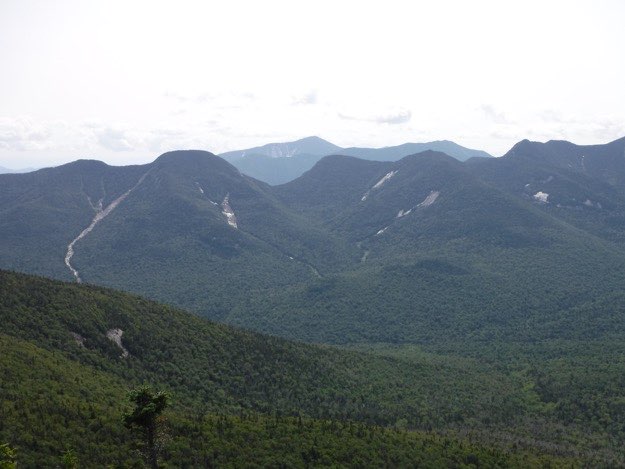
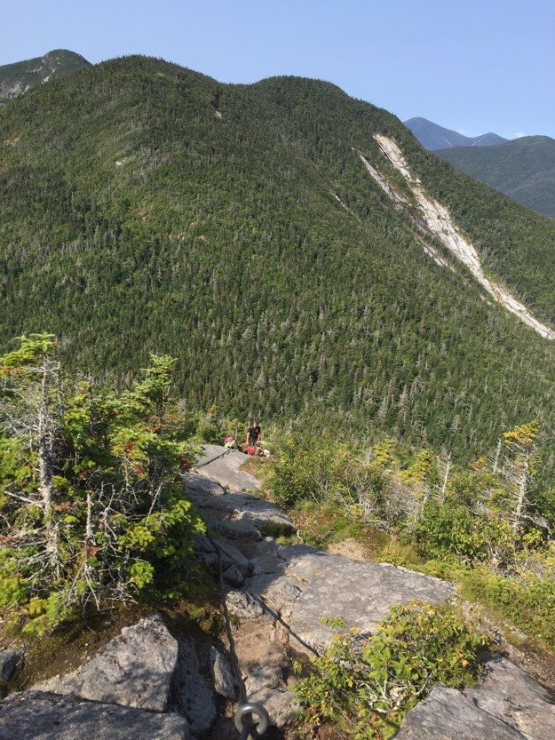
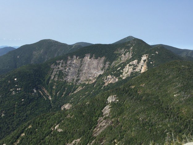
Yard Mountain and Big Slide, (being split by the dead evergreen tree, center), as seen from Lower Wolfjaw.
YARD
SUMMIT


NOT A
CAMP!


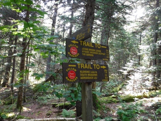
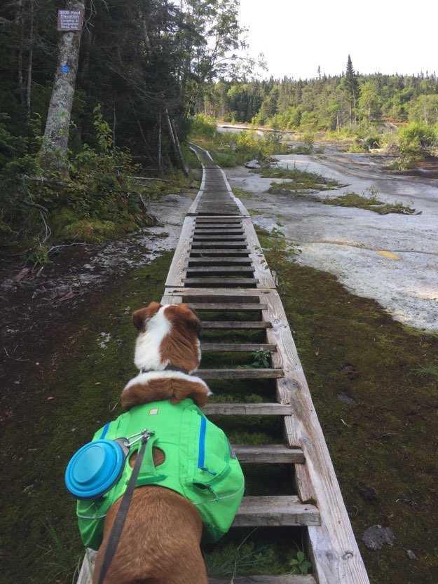
There sure are a lot of places you can go from the JBL!
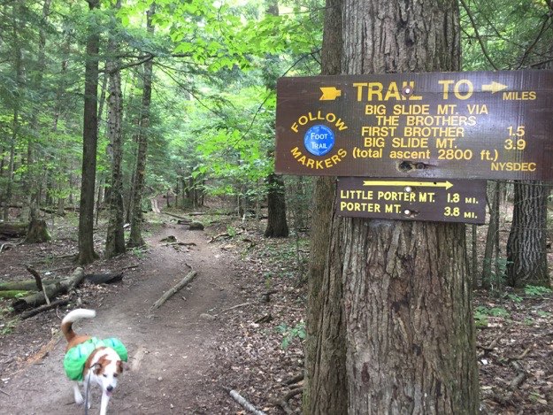
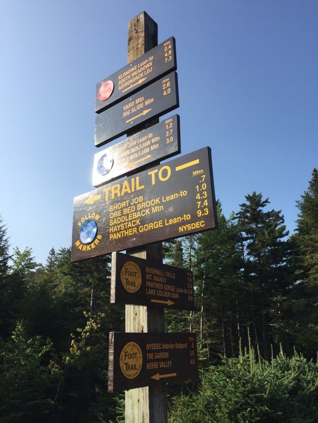
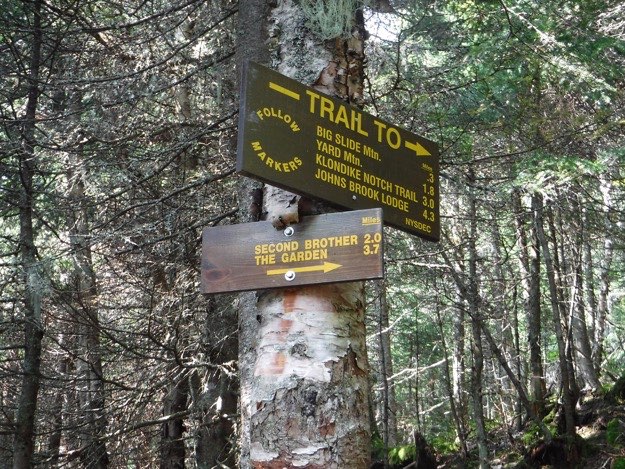
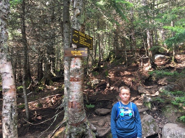
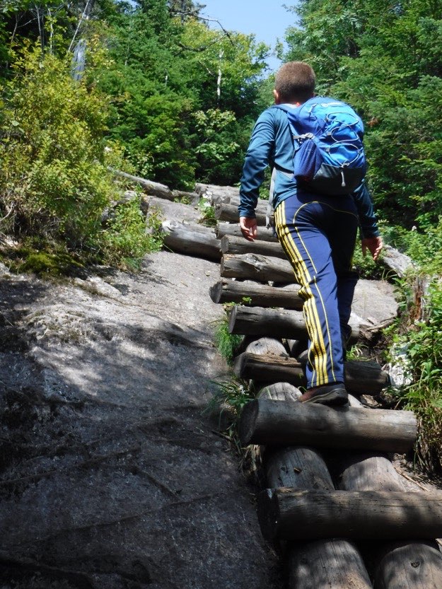
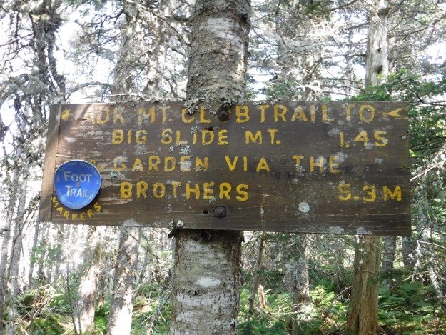
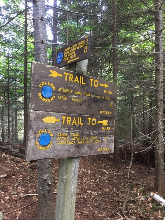
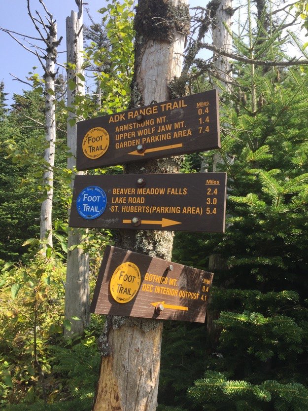
The trail sign you see right at the trailhead. Most day-hikers turn right, and head up Big Slide via the scenic Brothers trail. But since I’ve done that twice already, it was time to get there from a less-traveled trail. We went straight, down the yellow Phelps trail, and into the interior, towards the JBL.
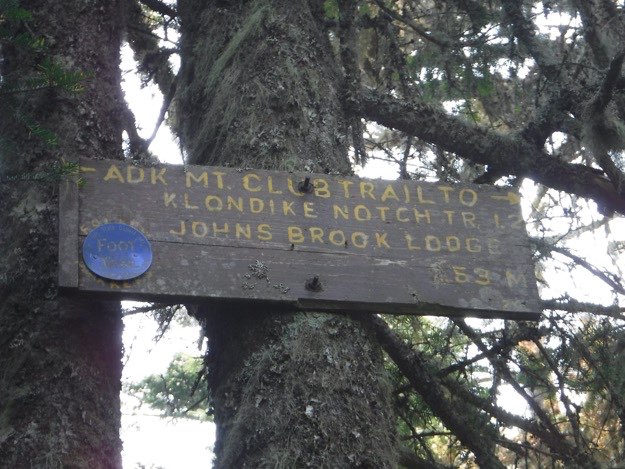
This sign on the trail is a sure sign we’re getting close to the JBL area.
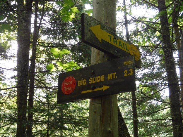
After leaving the JBL, heading down the yellow Phelps trail back in the direction of the Garden Trailhead, we meet up with our trail up to the summit of Big Slide in 3 tenths of a mile. Let the climbing begin!
The sign, in detail...
The upper half of the ladder has long-since disintegrated, so extra caution is definitely recommended here!
Collin nears the top of the ladder. The exposed rock slides of Lower Wolfjaw are seen in the distance.
After this, we arrived back at the car, and proceeded directly to the Noonmark for pitchers of Mountain Dew, and lots of belly-filling food. And there was much rejoicing...
BONUS MATERIAL!
While we did the Big Slide Loop, friends who were with us, and going a bit faster than us, decided to not only tackle Big Slide ahead of us on Friday, but also do Gothics, Armstrong, Upper Wolfjaw and Lower Wolfjaw on Saturday, (while we were doing Big Slide and Yard). I’ll give you a synopsis of this after we get our Big Slide/Yard hike out of the way, so be patient...
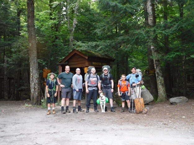
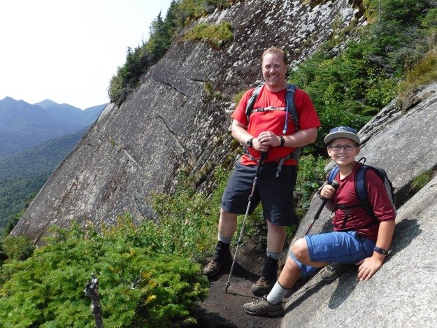
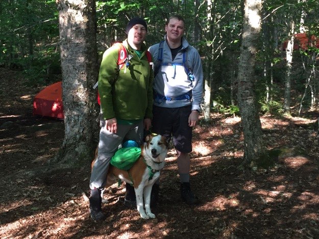
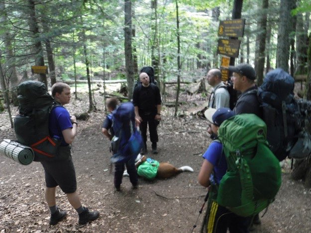
At the Garden Trailhead, ready to depart. From L to R: Collin with his 46er dad Andy, Mark, 46er Tanner with his dog Indy, Paul, my son Alex and myself.
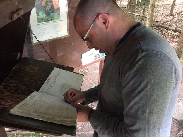
Mark needs this mountain for his 46er quest, so we thought it’d be good for him to sign all of us into the trail register.
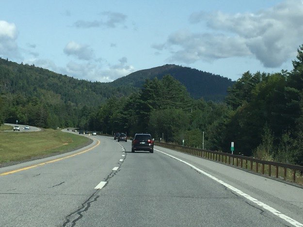
That’s us in the black Honda up ahead, as we travel north on scenic Rt. 87, (the Northway, as it is called).
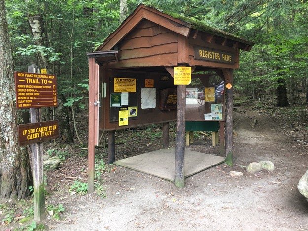
The trail registration kiosk at the Garden.
A NOTE ABOUT PARKING:
The Garden is one of the busiest, yet smallest parking lots in the high peaks region! It is virtually impossible to find a parking spot there during the summer hiking season, or busy holiday weekends. We had to leave 2 of our 3 cars down at the Roostercomb Mountain parking lot in Keene Valley. Please be aware that if you plan on parking at this trailhead, you may have to do the same. On Saturdays and Sundays in the summer, a shuttle may be running between the two lots, but I’m not sure of the exact shuttle schedule.
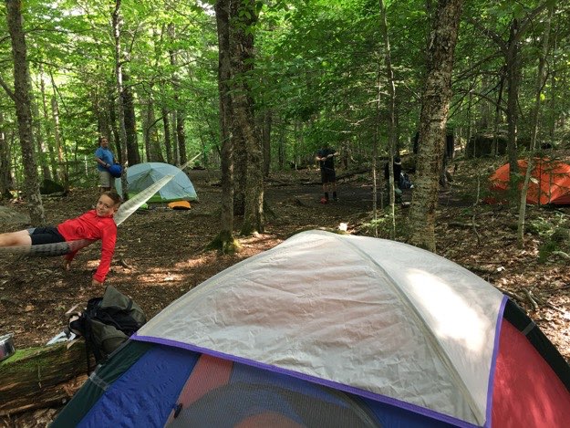
Our little tent city. Alex relaxes on our hammock, as I ready our tent in the distance behind him.
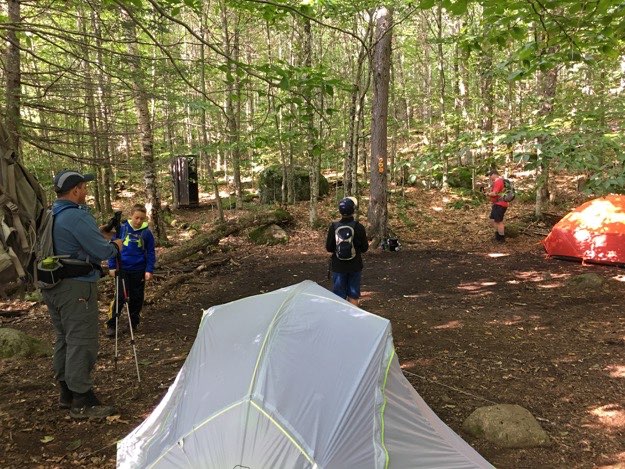
The next morning, we’re almost ready to depart for our big day hike up Big Slide.
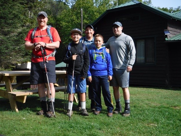
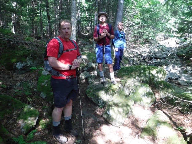
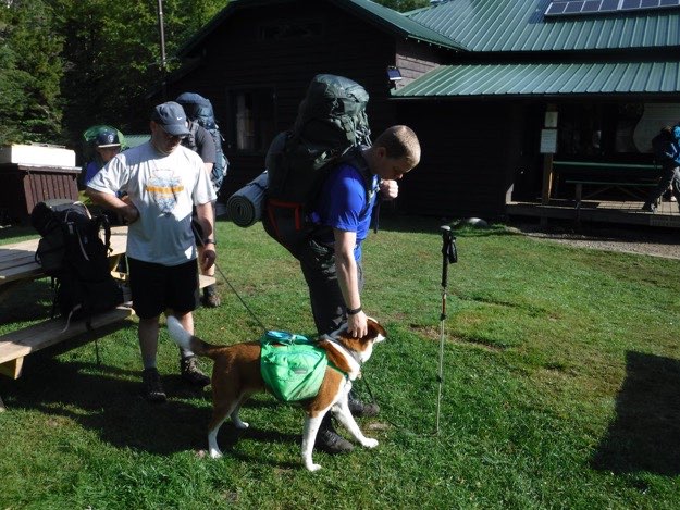
Andy, Collin, myself, Alex and Mark at JBL, after topping off our water supplies.
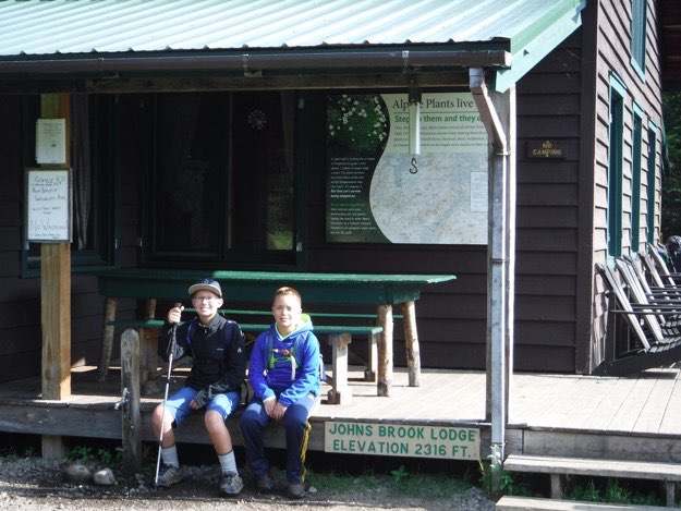
Collin and Alex sit next to the water spigot and elevation sign. Up above that sign is the scale where you can weigh your pack to see how much weight you’re lugging around. Behind that is the trail map of the area.
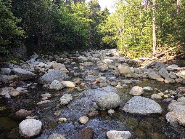
The trail follows Slide Mountain Brook about halfway up the mountain, and crisscrosses it a few times.
At one point, we get to climb an exposed rock face, offering some teases at the views we’ll be seeing later on. Don’t forget to look over your shoulder here, if you take this trail!
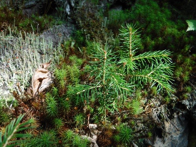
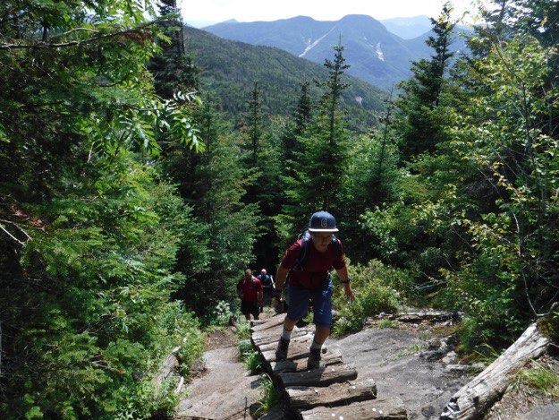
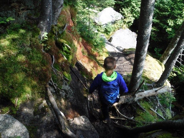
There is a lot of great scenery going up this trail, so take your time to soak it in. This is an atypical trail in the high peaks region. The trail is soft dirt and not many rocks or boulders to hop on, blessedly. It reminds me a lot of the trail up Mt. Marshall.
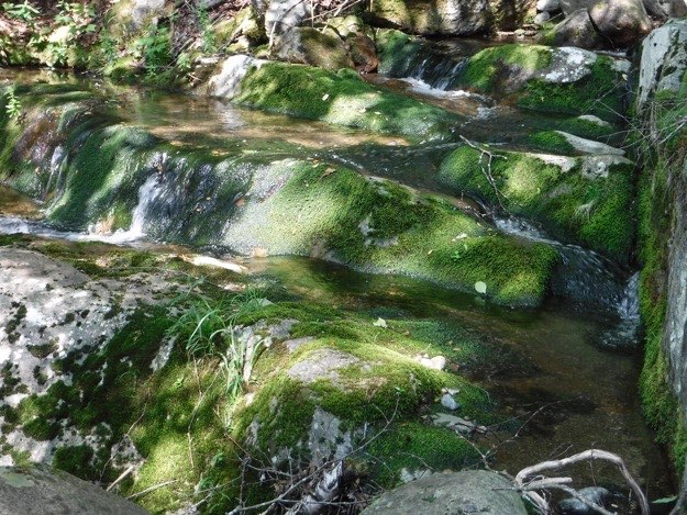
A lovely moss-covered stair-stepped section of the brook. This photo doesn’t do this sight justice in the least, unfortunately...
Still following the parallel to the brook, we take a food and water rest break from the ascending.
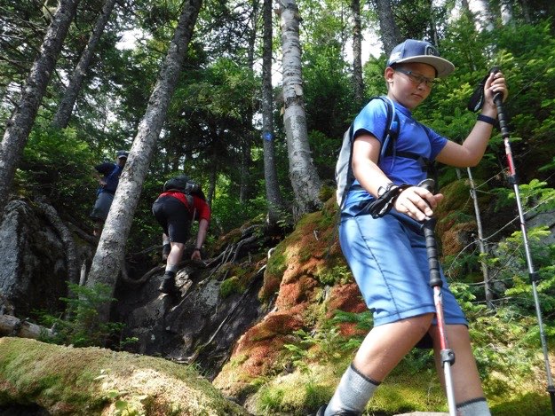
We have left the brook, and are now just climbing the steeper upper half of the trail. It won’t be too much longer until we hit the trail split that will either take us to the summit, or turn towards the Brothers, and back to the Garden.
Speaking of which, here’s that intersection! Only 0.3 miles to the summit, but it’s quite steep and technical!
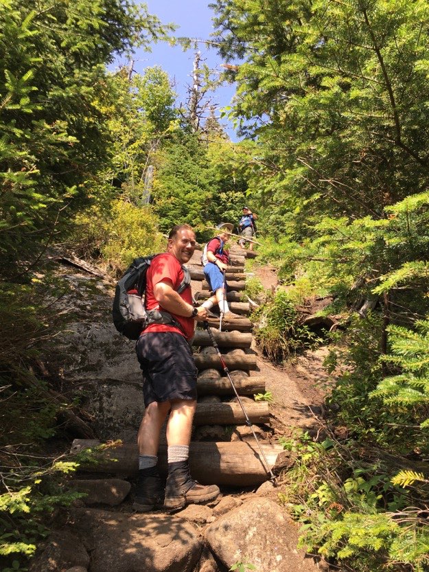
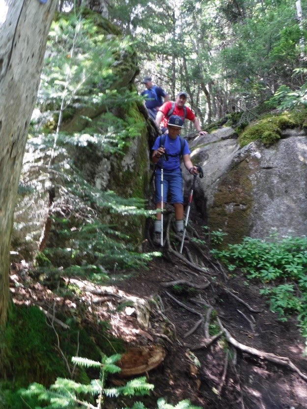
Welcome to the ladder section! Take your time.
Alex ascends the ladder confidently, yet cautiously.
After the ladder section, be sure to take the little offshoot trail to the left, over to see the “Big Slide” that this mountain is famous for. Here, Andy and his son Collin absorb the views from this amazing lookout.
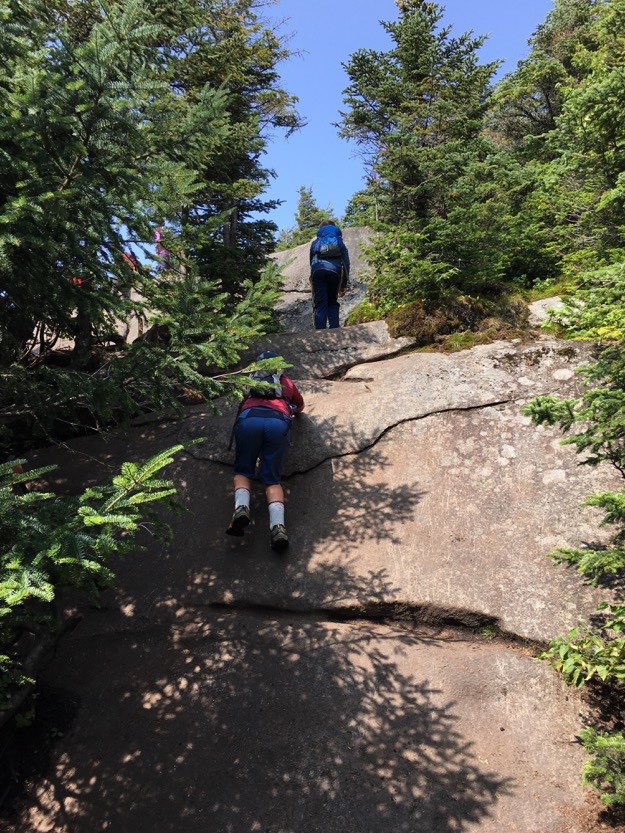
The final ascent to the summit is a bit of a scramble. Head the far left for the easiest way up. Here, Collin tries to go straight up the slippery, worn section of the rock.
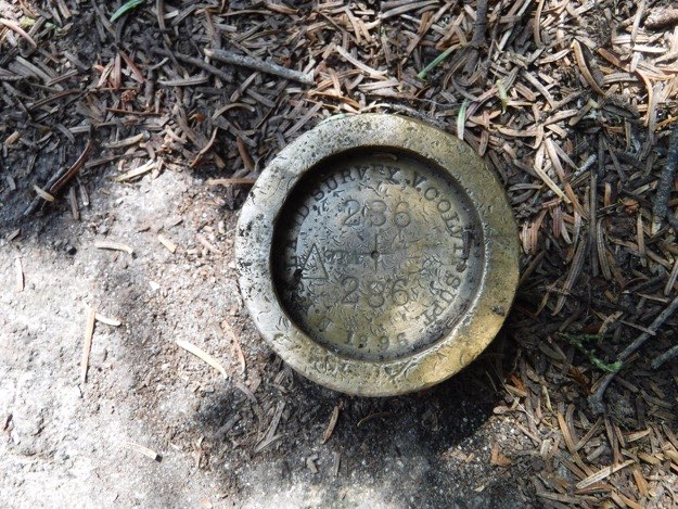
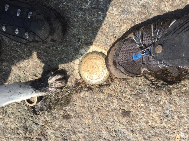
The summit marker on Big Slide is a bit atypical for ADK high peaks, but is nice to see nonetheless!
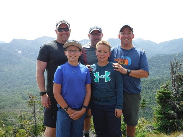
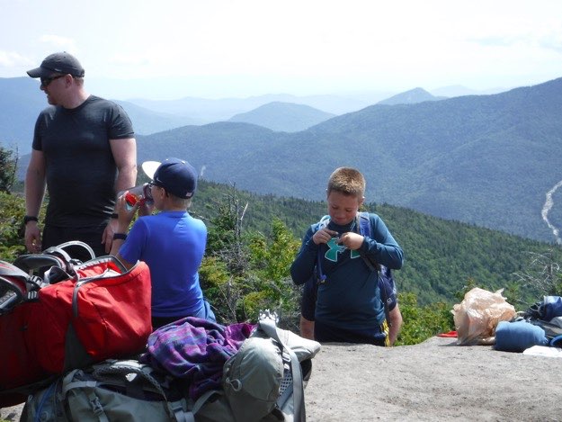
Our hiking party is happy to have reached the summit! Time to eat some lunch. Mercifully, it was very calm and sheltered from the cool wind, and we had a lovely time up there, soaking in the views as we ate and spoke with other hikers.
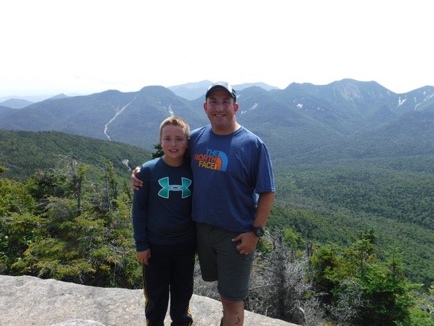
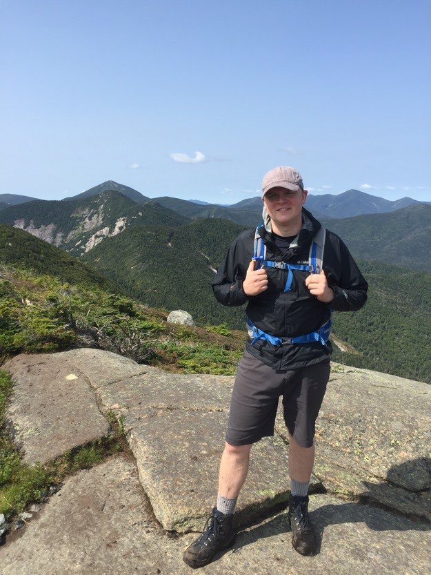
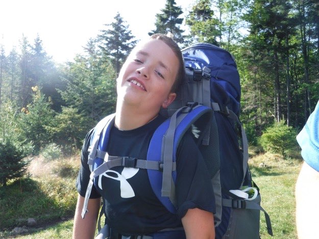
I congratulate Alex on getting his second high peak, with the Great Range in the distance and Johns Brook Valley below.
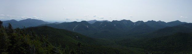
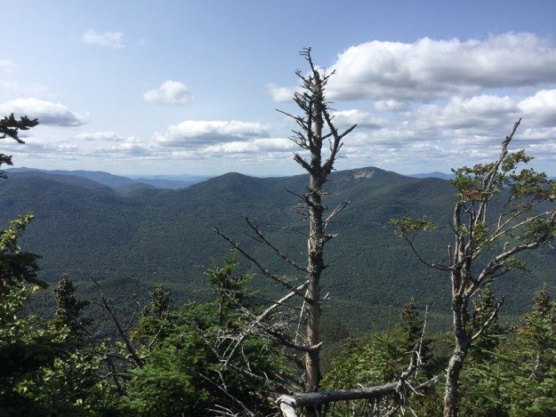
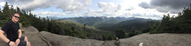
A big panoramic view, from L to R: Giant & Rocky Peak Ridge, Noonmark, Roostercomb, Lower Wolfjaw, Dix, Upper Wolfjaw, Nippletop, Armstrong, Gothics, Saddleback, Basin, Haystack (and Little Haystack), Marcy, Gray, and a bit of Yard in foreground. Way off in the distance on the left side are the Green mountains of Vermont.
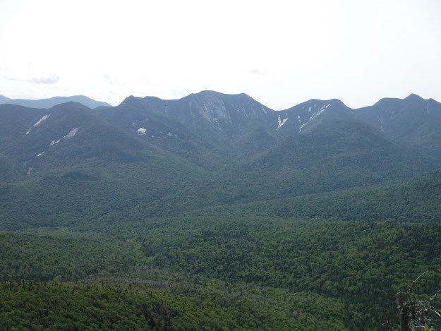
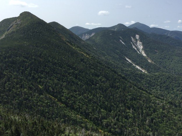
Lower Wolfjaw, Upper Wolfjaw and Armstrong in the middle distance. Dix and Nipple top in the farther distance.
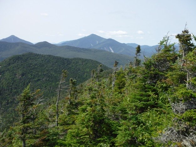
Yard in middle distance, then Phelps and Tabletop behind that, followed by Colden on the far left, a tiny bit of Iroquois peaking out behind massive Algonquin, and Wright Peak in front of that, with the bright white slide exposed.
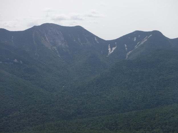
A bit of Upper Wolfjaw on left, then moving right, Armstrong, Gothics’s expansive exposed face, scratched-up Saddleback, and the triple-hump of Basin.
Gothics and Saddleback, and the Ore Bed trail that leads up the col between the two.
After rehydrating and refueling with lunch, it’s time to start getting ready to continue on our journey.
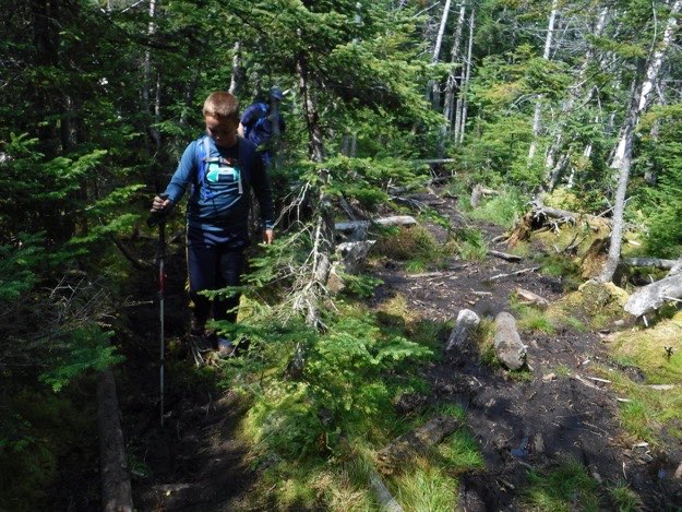
The trail on the summit of Big Slide showing us the way we’re heading, on the Blue Trail over towards Yard Mountain. This is unexplored territory for me, so I’m excited to see something new!
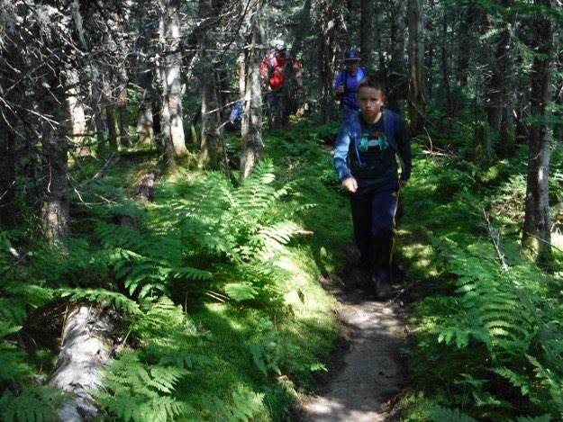
The trail over to Yard was amazing. It was a gentle descent across a fern-covered ridge. I thoroughly enjoyed it!
There were 2 mud bog sections along the way that required some careful stepping, but they were nothing like the dreaded mud bogs in the infamous Santanoni Range, that’s for sure!
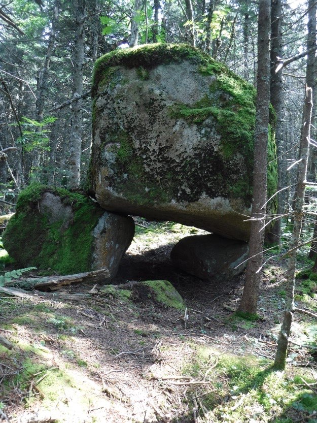
A huge boulder balanced on two other boulders provided some “whoa” moments with us all.
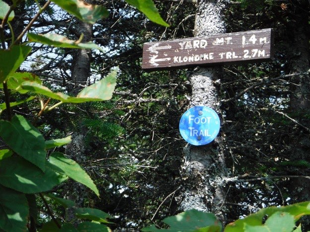
Near the unmarked summit of Yard is this sign indicating where we just came from. From here, there’s an unmarked herd path over to an unmarked small hillock that is the highest point, but sadly, we found absolutely no summit marker to speak of, and no views, either...
Another sign pointing to where we’re going. We’ll now start descending for real, down to the Klondike Notch trail.
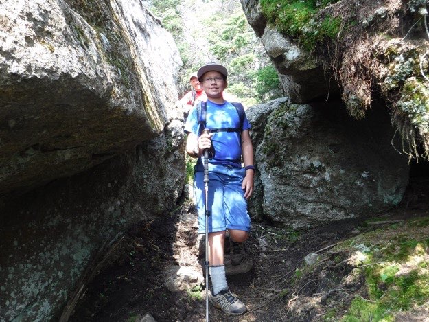
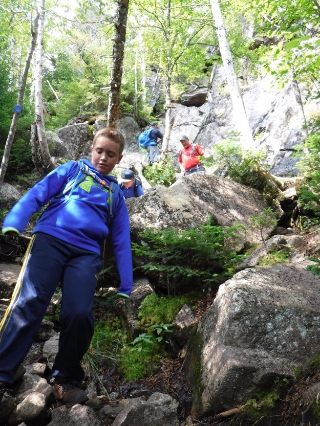
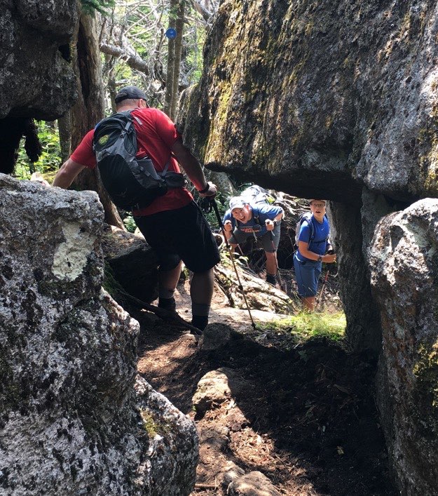
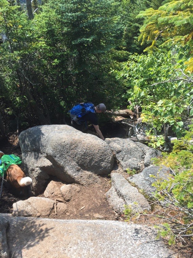
The trail down is very, very technical, and has lots of erratics, giant boulders and cliffs that can resemble ancient temples. Here, Collin and Andy squeeze through a narrow crevice between two giant boulders.
A steep root-strewn section required careful foot placement and attention.
Alex carefully descends onto a rock platform next to some red moss. To the left is a cliff dropoff, so caution is needed, for sure.
Collin walks past, as Andy takes his turn going down backwards, with Mark offering moral support further up.
You can see how crazy this section of “trail” is, and quite steep.
Andy squeezes through the shoulder-scraping section.
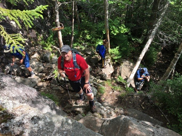
This is that same section as photographed by Mark, at the top. Notice the two brown trail signs on the tree above Andy, so you won’t lose your way in the confusion that is this section.
Alex goes up a short chute marked 3 ways, (2 cairns and a yellow painted arrow). I suppose that means that many, many hikers have missed this turn in the past, or there used to be another way to go here long ago...
That last section was supposedly 1.3 miles, but it sure seemed like longer. That’s likely because it was slower going, due to how technical that crazy descent was through those boulders, erratics and cliffs. It’d be a long and tough ascent up to Yard the other direction, I’d imagine!
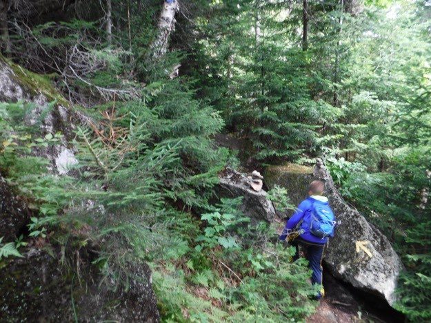
But finally, we reach the intersection with the Klondike Notch trail. We turn left, and head home to the JBL, down a mercifully easier and less-extreme descent. The latter few tenths of a mile follow Black Brook, and it leads us all the way JBL.
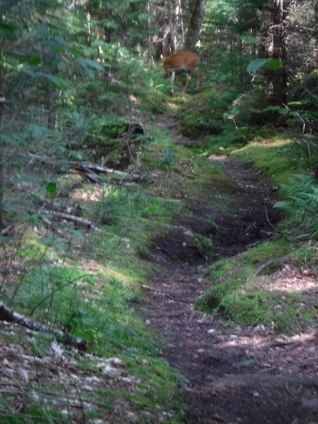
After all the years of hiking in the high peaks, I finally saw some wildlife on a hike. Here a Whitetail deer and his friend (hiding), are on the trail far up ahead. We waited until they moved on, before proceeding and bothering them too much.
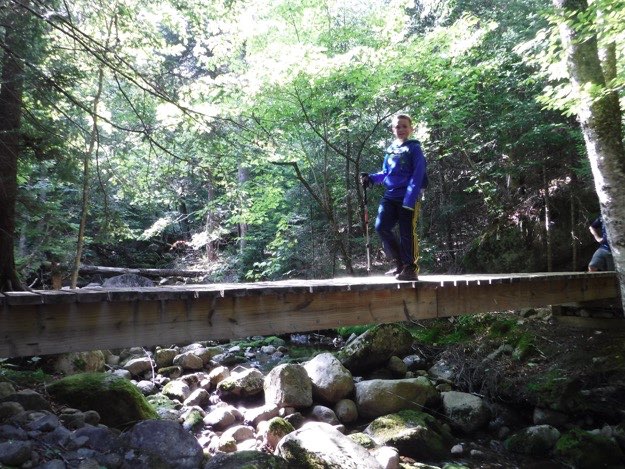
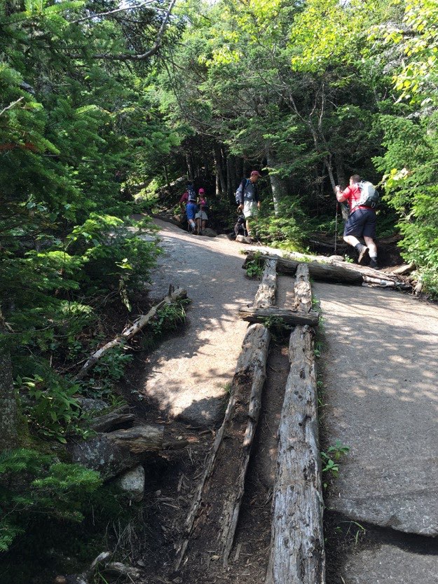
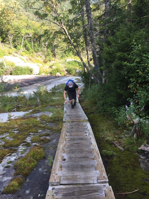
Alex is happy to cross the bridge, as the end of our journey is in sight. Just another few hundred feet up the trail is the JBL, whew!
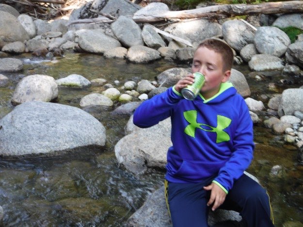
Alex joyfully enjoys his cold can of refreshing (and appropriate) Mountain Dew he has been saving for his post-hike reward.
Johns Brook, where we wash the sweat off our brow, and cool off before dinner.
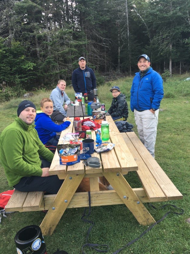
We brought our food and stoves to the picnic clearing adjacent to the Johns Brook Lodge, and shared stories from our day of hiking while we cooked our dinners.
MEANWHILE...
Let’s now join Tanner, his dog Indy and Paul for their adventures Friday on Big Slide, and then their Saturday hike on Gothics, Armstrong and Upper and Lower Wolfjaw!
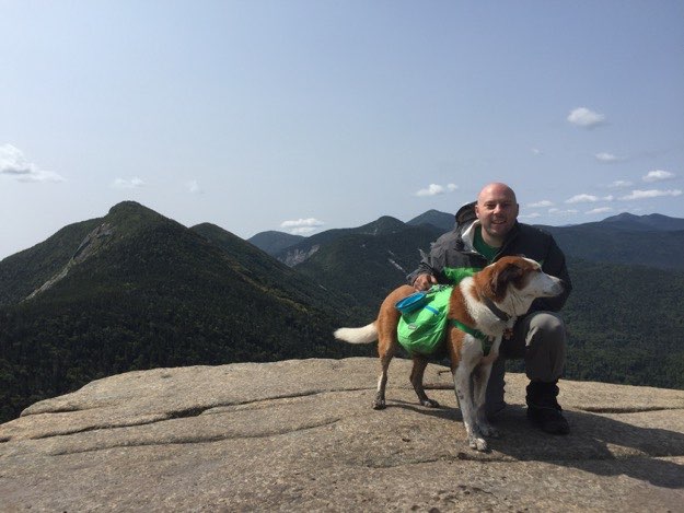
Here Paul takes in the Big Slide Panorama on the summit.
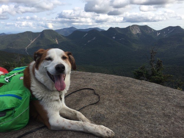
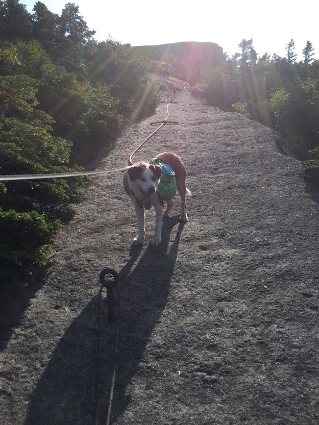
Indy is also appreciating the view, as he catches his breath.
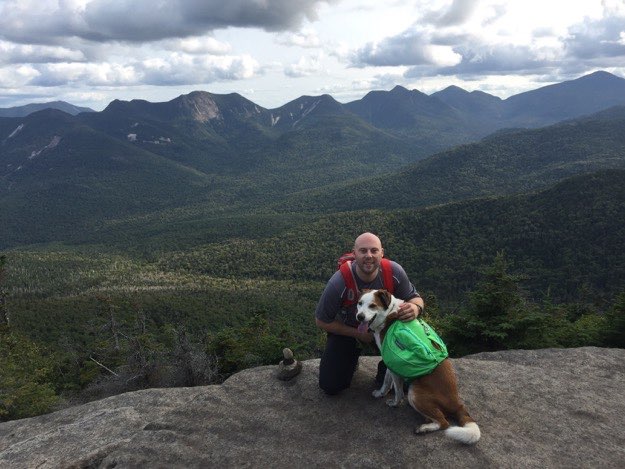
Tanner congratulates Indy on a job well done, then proceeds to point out the mountains that they’re going to hike on Saturday.
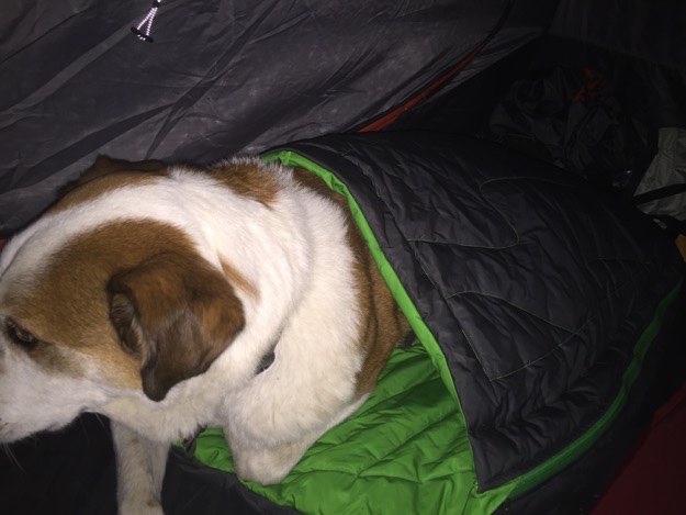
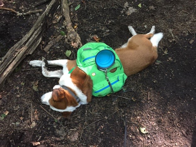
Many of you might wonder “how did Indy stay warm on those 37-degree F nights?”, and here’s your answer. He had a doggie sleeping bag and insulated sleeping pad, which likely rivals some of the best stuff for humans to sleep in on cold, chilly nights!
Saturday morning, Tanner, Indy and Paul get ready to depart our camp for their hike up the Ore Bed Trail.
They’re following the blue trail up the Ore Bed Trail that will take them towards the col between Gothics and Saddleback.
Indy starts heading up the infamous long staircase section.
Paul making his way up the steps.
Paul and Indy take a breather at the start of the cable section going up Gothics. Behind them looms Saddleback and a bit of Basin on the far left.
Indy patiently waits for Tanner on the cable section.
The obligatory “boot” shot, of the 3 hikers on Gothics’ summit.
Part of Saddleback on right side, with Basin’s scarred back in the middle of the photo. Haystack is on the left side. You can also see Marcy peaking up behind Basin, Skylight to its’ left, and Gray peak to its’ right.
Paul triumphantly poses on Gothics.
In the col halfway between Gothics and Armstrong is this intersection, where you can descend down into the Adirondack Mountain Reserve (AMR) land and St. Huberts.
A look back at Gothics, Saddleback, Basin, Haystack, Marcy and more from Armstrong.
Tanner and Indy atop Armstrong.
Paul and Indy descending down into the deep col between the Wolfjaws from Lower Woljfaw.
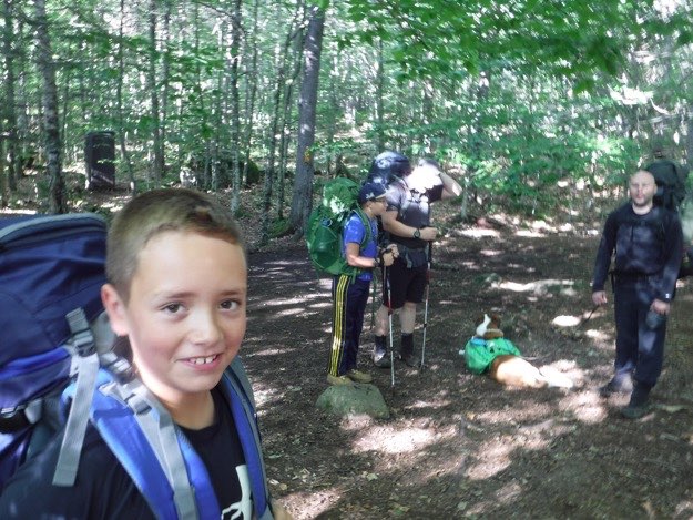
Back at camp finally, Indy flops down for a well-deserved rest. It was a busy day!
LATER THAT SAME DAY...
Both hiking parties have finished their epic day hikes, and reconvene after having cleaned up, put on some fresh, warmer clothes.
Sunday morning, and we’re all packed up. Time to don our now slightly less-heavy full backpacks, and head back down to the cars.
Mark strikes a pose (middle), as we get ready to depart.
One last stop at the lodge, since it’s on our way.
Alex is ready to go; enough delay! He is eager to get to the Noonmark Diner for a seriously good meal.
One last water break on the trail on the way back to the Garden Trailhead.