Algonquin, Wright & Iroquois


I didn’t do Iroquois; you’ll see why later on...
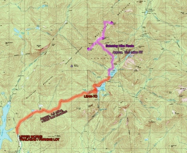
Topographic map courtesy of Topozone.com
July 2008
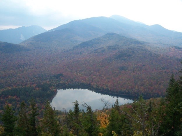
The MacIntrye mountain range as seen from Mt. Jo. From left to right, Wright Peak, Algonquin, Iroquois and Marshall off the back...


WRIGHT PEAK
ALGONQUIN
IROQUOIS
This trip, we had planned to do 3 peaks minimum, including Algonquin, (2nd highest at 5114 ft.), Wright Peak, (16th highest at 4580 ft.), and Iroquois (8th highest at 4840 ft.). If we were feeling particularly good on Sunday, we were going to also attempt to do Mt. Marshall, (25th highest at 4360 ft.). Well, sometimes things don’t work out the way we all plan...
We had no problem ascending Algonquin, but after that, I started feeling a “bonk” coming on. Bonking is the term for extreme sluggishness, tiredness, and lack of energy, usually brought on by dehydration and/or lack of eating proper energy food combined with strenuous activity. High temperatures can also help to bring on a bonk.
On the way down Algonquin was when it started to really kick in. The ascent of Wright Peak was really tough, but at the top, I had a quick chance to rest. Unfortunately, it wasn’t enough. The descent down Wright, and the ensuing 0.9 mile hike back up to Algonquin was the toughest thing I’ve ever had to do.
I slowed the whole group down so much, that I felt guilty. So once we got back to Algonquin, I took a nap, allowing them to continue on without me to Iroquois. This was a choice I’ll regret forever. Now I have to go back and do Iroquois again someday!
(Part of my Original 46er quest)
Now it’s my turn...
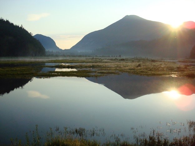
Meanwhile, I capture the sunrise above Mt. Colden. An unforgettable view.
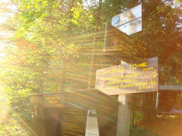
The signs and registration kiosk at the Flowed Lands area.
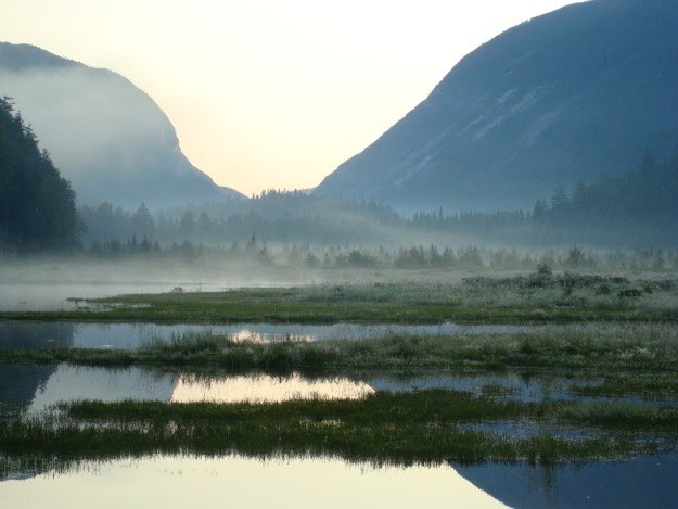
The morning fog rolls slowly, if not mysteriously, over the Flowed Lands.
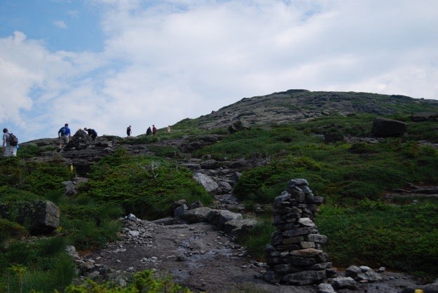
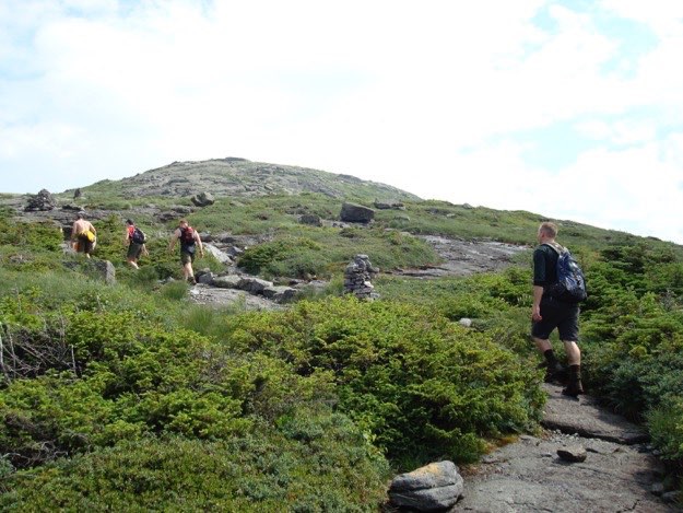
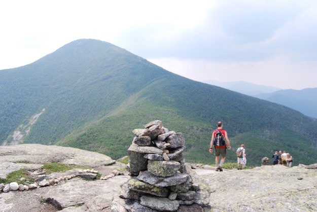
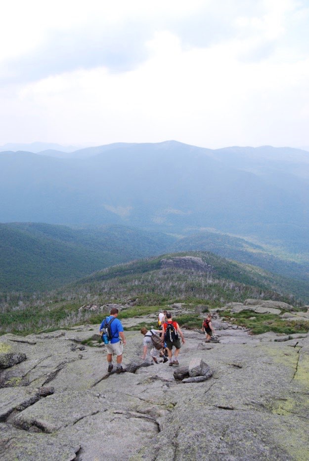
Finally we reach the intersection between Algonquin and the intermediate Boundary Peak. The guys follow the cairns (rock piles) and yellow painted blazes to the summit of Algonquin ahead.
A zoomed-in view of Avalanche Pass from the Flowed Lands.
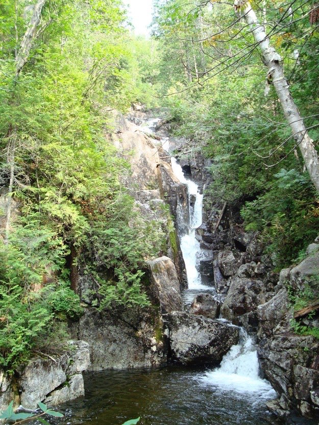
A beautiful waterfall that the trail follows up the mountain.
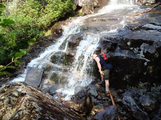
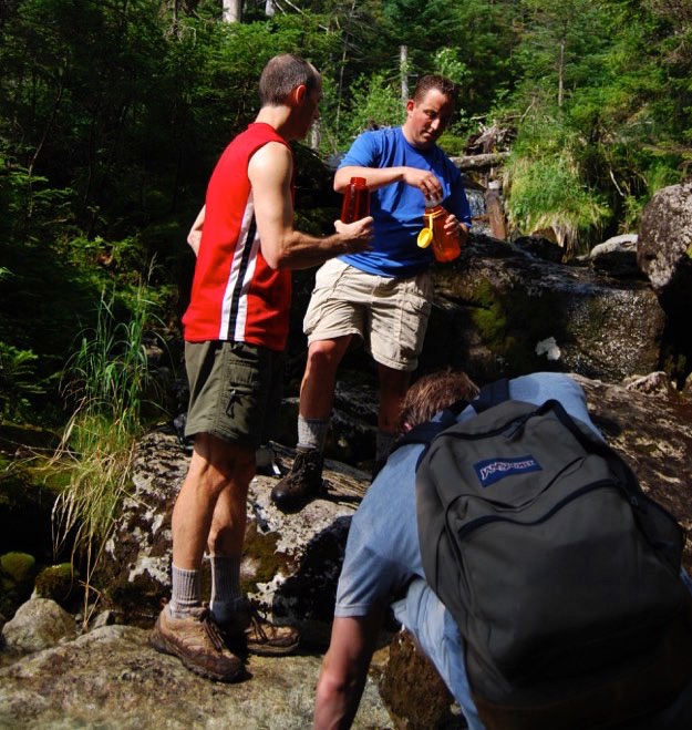
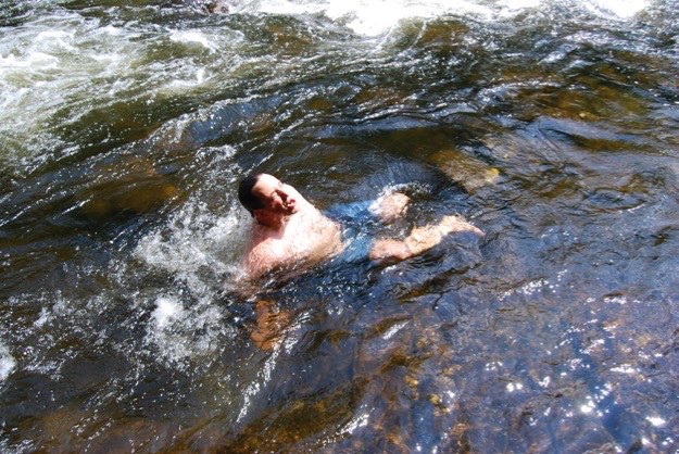
Andy takes his turn at dunking his head in the cool water.
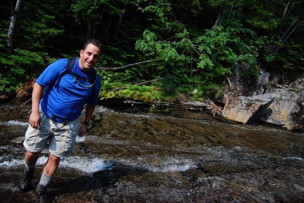
Taking a break to purify water.
Saturday — The peak hike — approximately 12.5 miles round trip
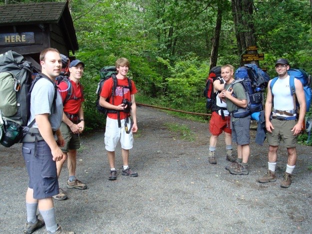
Friday — The hike to camp — approximately 4.5 miles
Ready to depart the Upper Works Trailhead in the Tahawus area in the southwest corner of the high peaks.
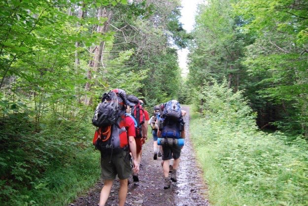
On the way up the Calamity Brook Trail.
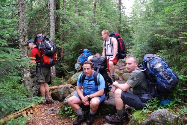
We take a breather along the trail.
Climbing the slide.
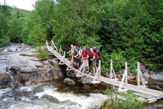
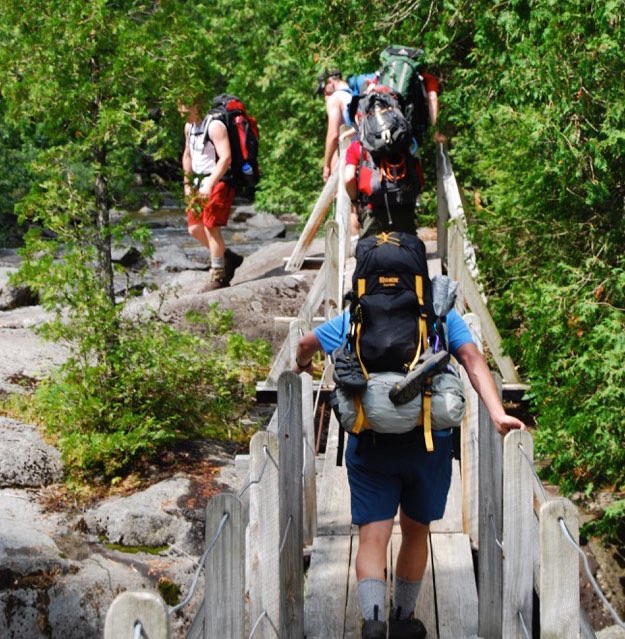
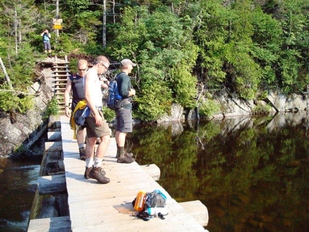
Crossing a bouncy suspension bridge.
We’re on our way now.
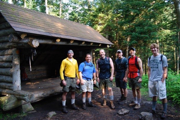
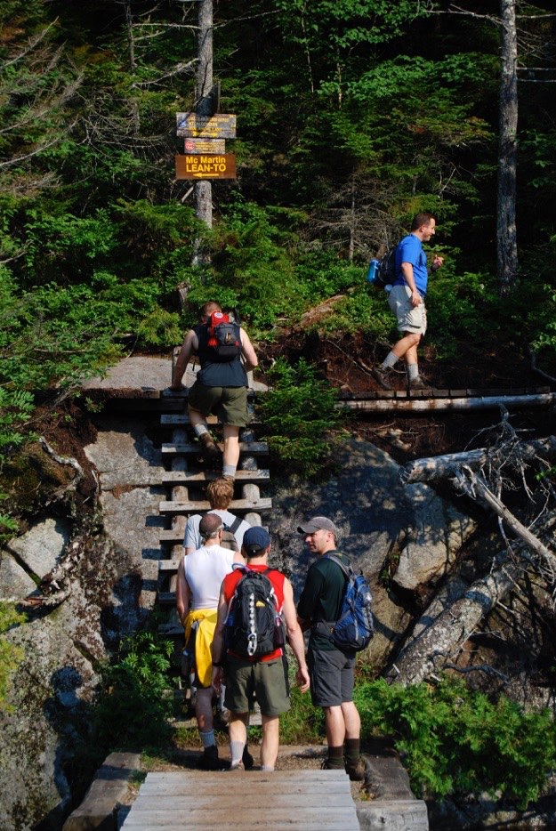
We arrive at our base camp, a lean-to at the Flowed Lands area.
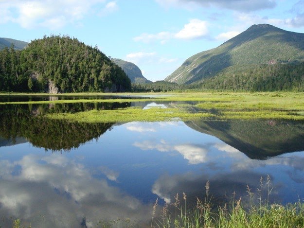
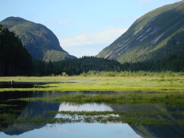
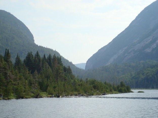
Now you know why this area is known as the Flowed Lands. This is looking northeast, right up Avalanche Pass. On the far left is the shoulder of Algonquin, in the middle-left is Avalanche Mountain, and on the right is Mt. Colden.
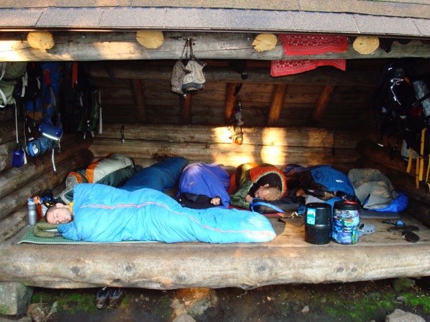
The boys all snug in their sleeping bags.
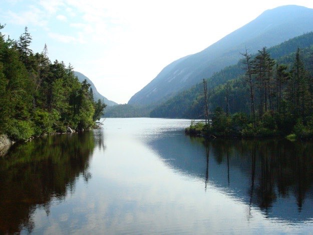
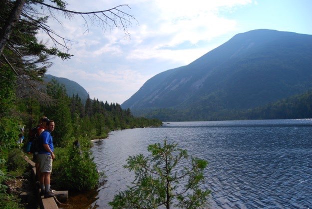
The view north from the dam out over Lake Colden. Mt. Colden is on the right.
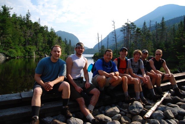
The dam at the south end of Lake Colden.
A zoomed-in view of Avalanche Pass.
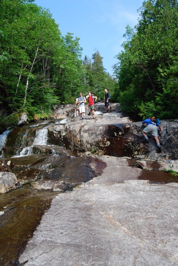
The guys stop for a quick photo op at the dam.
Okay, time to get moving on to Algonquin.
We walk on some boardwalk along the western shore of Lake Colden for a bit.
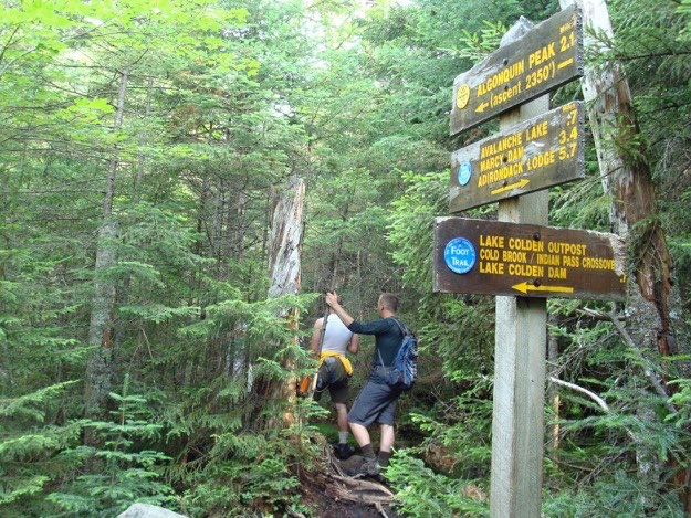
Here’s the turn west towards Algonquin. We’re going to start climbing now!
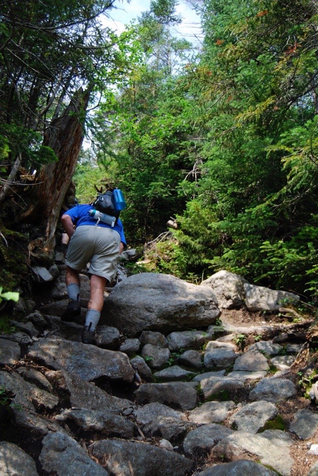
Feeling refreshed, we press on up a rock slide that is also a creek.
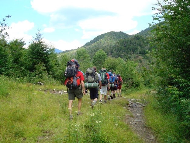
Back up the boulder-filled trail...
Nearing the top of the slide, we turn around to see Colden with Marcy, Skylight and other peaks behind us.
Almost there!
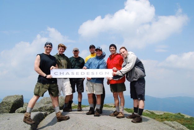
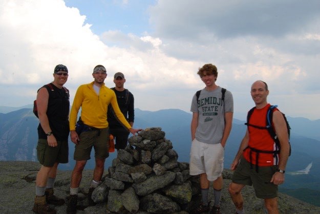
We did it! We summited Algonquin; New York State’s second-highest peak.
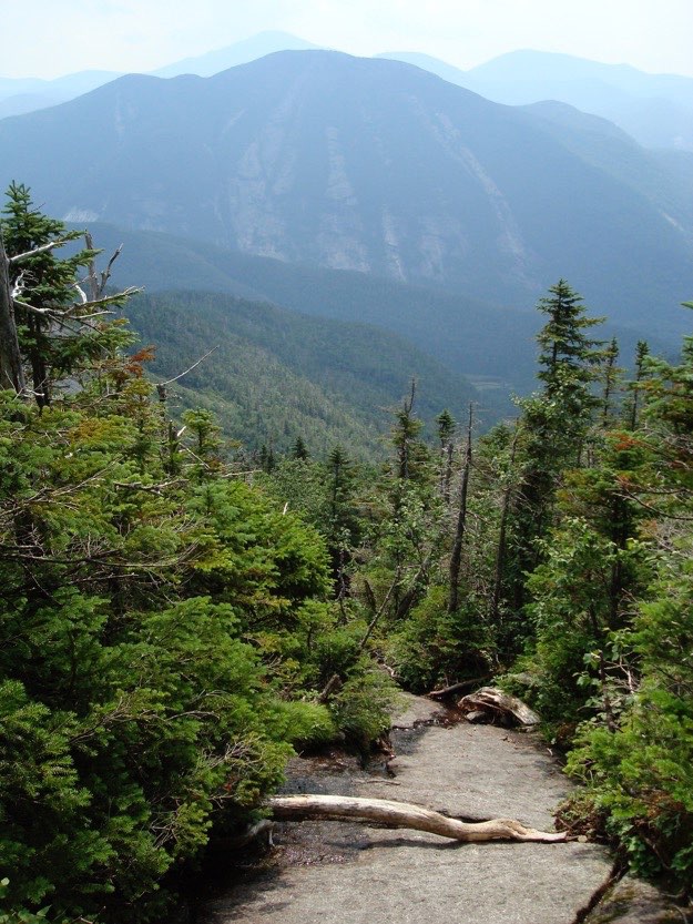
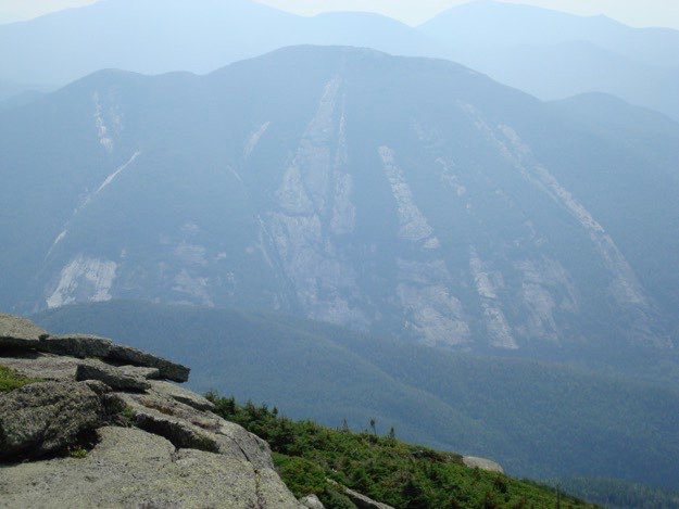
The view of next-door neighbor Colden from the summit of Algonquin. The slides are just amazing to behold.
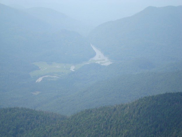
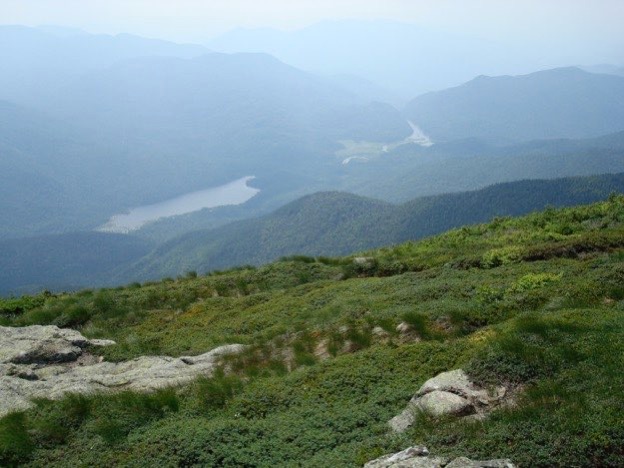
A zoomed-in view back to where our camp is located; the Flowed Lands area.
The valley to the east holds Lake Colden and the Flowed Lands a bit further off in the distance.
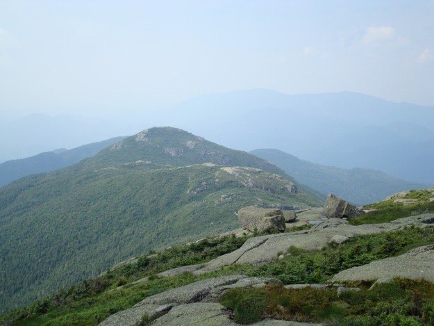
The view back to Boundary Peak, with Iroquois immediately behind.
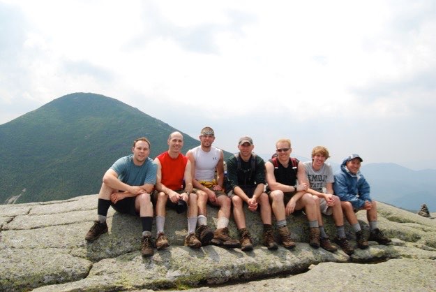
Here we are on Wright Peak, with Algonquin behind us to the southwest.
*NOTE: even though I am smiling here (at the end in the blue jacket), the truth is that I’m suffering through a massive “bonk”; a tremendous drop in energy due to dehydration, lack of food, lack of proper training, etc. This will come into play even more later on)...
Heading back towards Algonquin now.
Walking down Wright to pick up the steep trail that will go left, towards Algonquin.
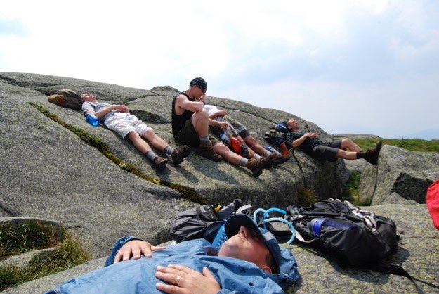
Taking a much-needed rest atop Algonquin after the steep ascent back up from Wright. This was the worst point of the bonk. I just needed to take a nap. I told the guys that I was in no shape to press on to do Iroquois with them, and that they should go without me. I was going to continue resting. MAN, do I regret not doing Iroquois right now!!!
The guys, (minus me) atop Iroquois, with Mt. Colden off to the far left, and the flowed lands off to the far right. The clouds are starting to get denser and darker. Signs that a storm may be coming soon...
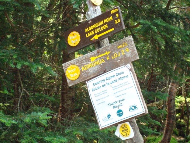
The signs at the Wright Peak turn-off. We had another 0.9 steep miles back up to the summit of Algonquin, and it went very slowly, because I was in full bonk mode. Every step was heavy and laborious. I needed to take a break every couple minutes. I slowed the entire group down. It was embarrassing and frustrating.
Well, after a quick 1/2 hour nap, I felt noticeably better, I also felt alone. Alone because my group was by now on their way back from Iroquois, but also because the 25 other people on the summit of Algonquin had fled. Why? Because off to the west was a line of thundershowers, heading right towards us! So I hiked back down the back side of Algonquin to meet up with the guys. After waiting 5 minutes, they finally appeared, and we began heading down into the Lake Colden valley. Our pace quickened, however, when we saw the first lightning bolt, and heard thunder almost immediately, indicating just how close it was to us. There’s nothing like being on a mountain top with a thunderstorm overhead to make you feel exposed!
We literally ran down the mountain in a downpour. These were not ideal hiking conditions, to say the least. In fact, it was downright dangerous. Luckily, none of us got hurt, and we made excellent time back to camp. I was feeling great by this point, fully recovered from my bonk, thanks to my nap, massive hydration efforts on my part, and energy bars.
We got back to our dry lean-to, and by then, the storms had passed. We changed into dry clothes, made dinner, then promptly crashed for the night.
The next day, the cameras barely came out, except for the end, when we took a refreshing and cleansing dip into the headwaters of the Hudson river. That sure felt good!
Then it was off to the Long Lake Diner for some massive caloric intake!