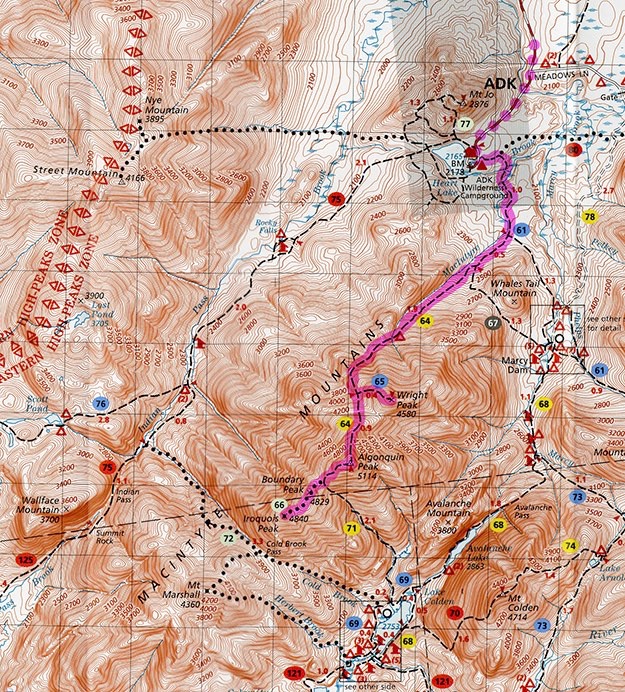
Wright, Algonquin & Iroquois

September, 2020
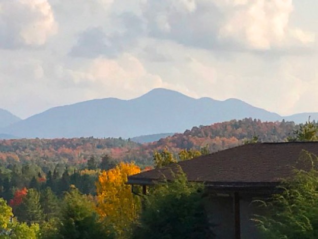
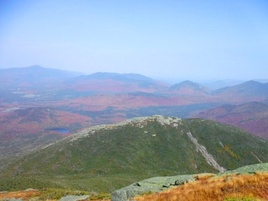
The view of 3 of the 4 mountains in the MacIntyre range we’d be tackling from our motel room in Lake Placid.


ALGONQUIN
IROQUOIS
One last time, with feeling...
After hiking 45 of the 46 high peaks in ten years, our friend Pete had just one peak left to become a true 46er. So we gathered up the troops, headed up to Lake Placid, and helped him complete his epic journey.
We stayed at the always-excellent Art Devlin’s Olympic Motor Inn, which is conveniently-located in the village of Lake Placid. We had a second floor room, with a great balcony view of the high peaks, and specifically, the MacIntyre range.
While Pete just needed the easiest peak to get to, Wright Peak, (16th highest in NYS at 4,580 ft.), we figured we’d make a longer day hike out of it, and also ascend Algonquin Peak, (2nd highest in NYS at 5,114 ft.), and Iroquois Peak (8th highest in NYS at 4,840 ft.), while we were in the neighborhood. This was also convenient, because 6 of the guys in our party also needed them for their 46er lists.
So we tried to wake up very early with fingers crossed to get one of the last parking spots at the always-crowded Van Hoevenberg trailhead near the Adirondack Loj. We arrived at 5:20 AM, and soon found we were too late—the lot was full. So we had to turn around and park a mile away, and walk to the trailhead in the dark with headlamps on. This unfortunately added an extra mile each way to our hike, but in the end, it wasn’t too bad.
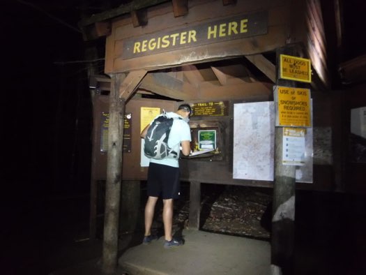
So we began the official hike after Pete signed us in at the register, and hiked through the dark woods with our headlamps on for about 45 minutes, before we had enough pre-dawn light to hike by without them. We first got Pete’s final peak out of the way, by hiking up Wright. We then hit Algonquin, and then went over Boundary Peak to get to the farthest-out Iroquois. Then it was time to turn around and go back the way we came.
All told, we hiked a grand total of 13.2 miles, in 11 hours and 39 minutes, (bear in mind, this time includes the extra two miles of road hiking, a bunch of breaks for snacks/meals, photography, and just general resting). It is very obvious that we weren’t trail-running — we went at a “comfortable pace”, to be sure. We ascended 6,058 feet, total for the day.
WRIGHT
TRAILHEAD

(Not of my original 46er quest)
Wright Peak
Algonquin Peak
Iroquois Peak
Boundary Peak
(not a 46er)
Topographic map courtesy of the Adirondack Mountain Club.

PARKING SPOT (ROAD)
Another food break, as we start ascending the lower part of Algonquin.
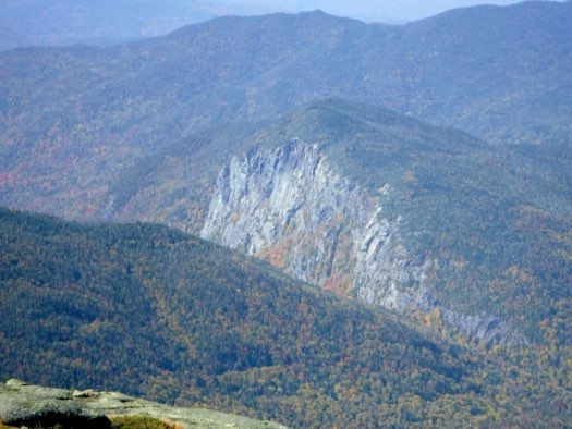
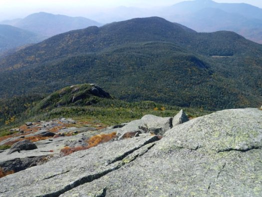
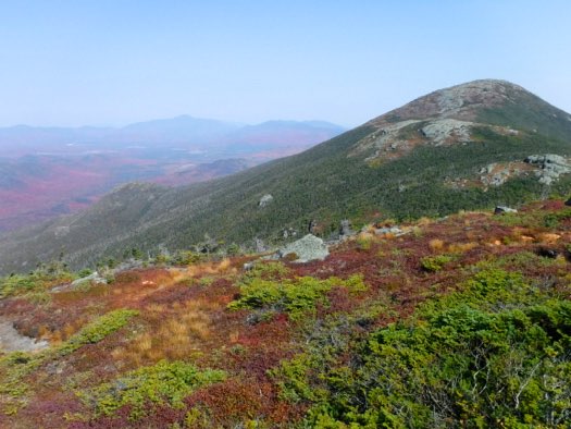
A zoomed-in view towards the bald summit of Boundary Peak in the foreground, and farther Iroquois Peak where we’re going to next. Off in the distance in the upper right corner is Santanoni Peak, with the white diagonal slide.
Pretty soon, it was time to head back north, towards Boundary, then Algonquin. You can see the dark trail in the woods just above the gray exposed rock in the center.
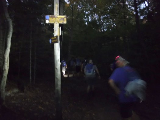
We use our headlamps to light Pete up while he signs us in at the trailhead. We then head south on blue trail #61.
We take the right turn at the next intersection, heading towards Algonquin on Yellow trail #64.
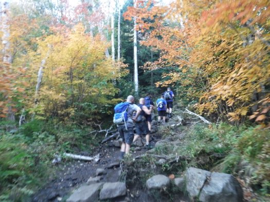
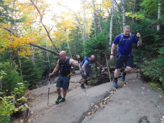
Taking a break along the trail before it starts to get real steep.
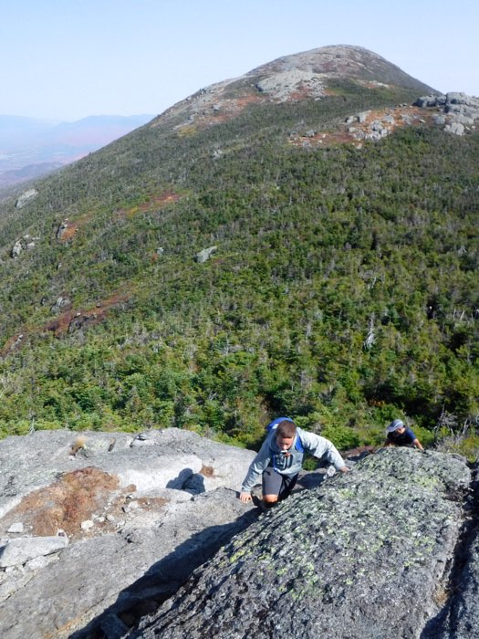
Andy leads Jim and Mark up one of the first slab climbs we encounter. A good warm-up for future, tougher and longer slab climbs coming.
It was now time to brave the wind, and get off Wright, to ascend imposing Algonquin.
This is the long exposed slab going up Algonquin. It is moderately steep and long, but by comparison to many other high peaks, it wasn’t that difficult...
A view back down the long slab.
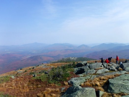
A panorama looking east.
The alpine zone atop Algonquin, looking northward.
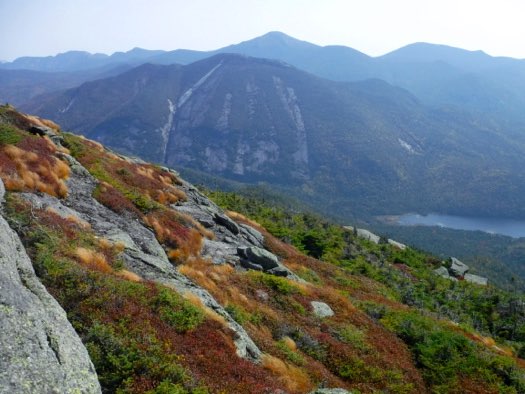
Looking east, the spectacular view of the many slides on Colden, with Mt. Marcy behind.
The imposing cliffs of Wallface mountain to the southeast. Indian Pass is in that deep valley.
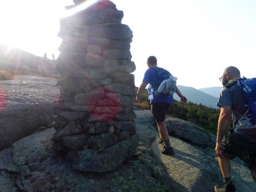
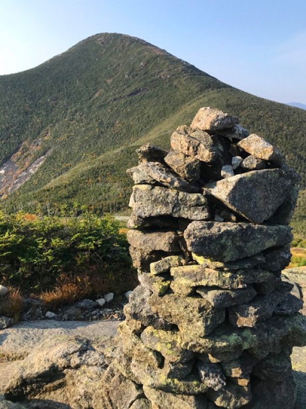
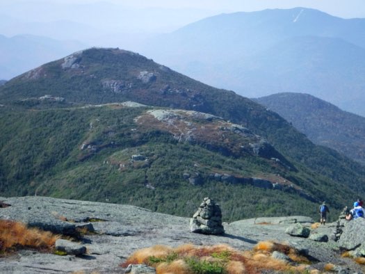
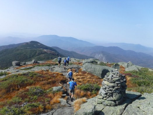
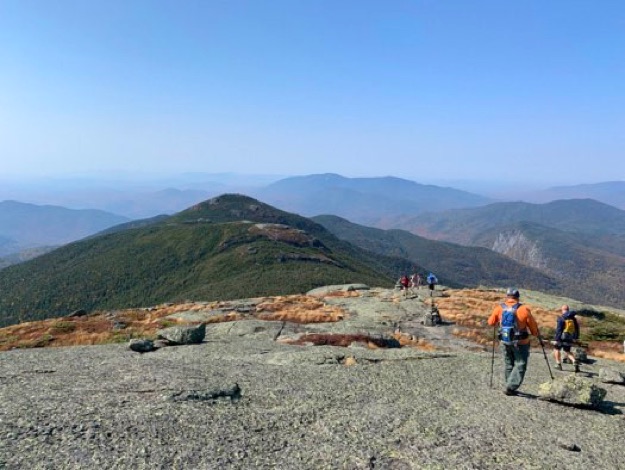
Finding our way was easy, thanks to some very large cairns to guide us.
Trudging along the bouldery trail towards the mountain.
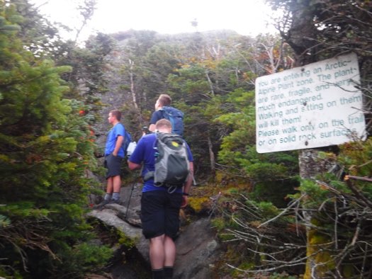
Not long now until we emerge above treeline, and need to watch our step so we don’t trample fragile plants.
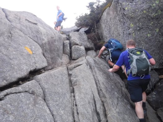
Just after we finish getting up this tricky crack, we emerge from the shelter of the trees and are slammed by steady 40-mph cold winds, all the way to, and including the summit.
Alex and Mark walk past one of the tallest cairns in the Adirondacks on their way to the summit.
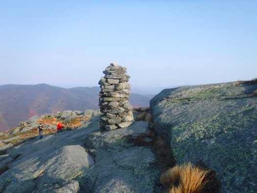
Same cairn, looking back down the mountain.
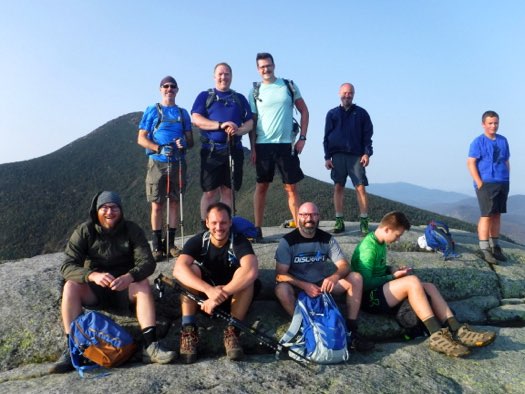
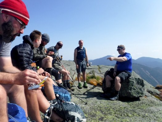
Our hiking party has reached the summit of Wright. Directly behind us is our next goal, Algonquin, but first, we’ll find a spot to get out of the whipping wind and celebrate Pete’s final summit!
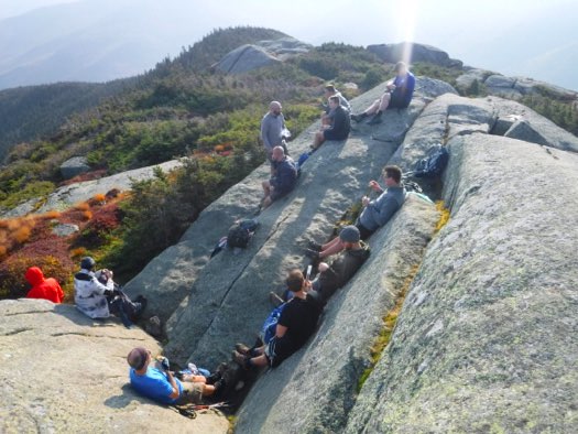
This notch just to the east of the summit is sheltered from the wind, and in the warming sunshine to refuel and rest for a few minutes.
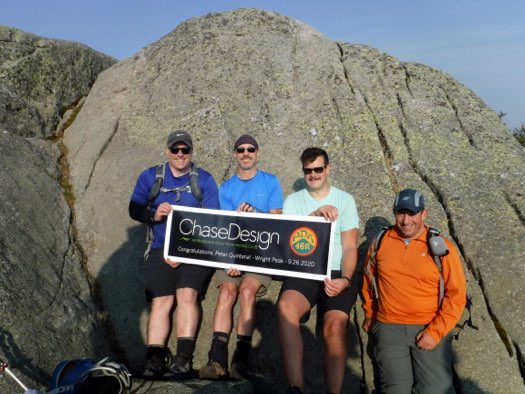
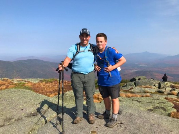
Andy, Chris, Pete and I (all coworkers), congratulate Pete on his accomplishments!
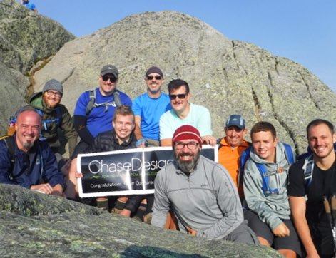
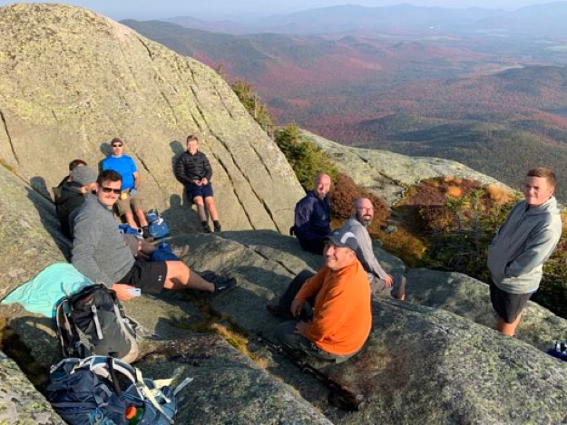
Then the rest of the crew jumps in for the group photo.
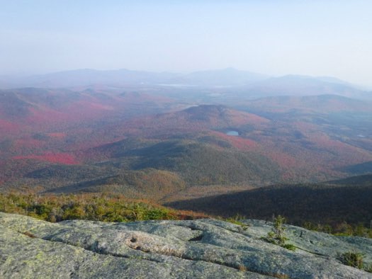
The view north shows some amazing fall foliage. The lake in the center is Heart Lake, near the trailhead we left from before dawn, with Mt. Jo directly behind it. The tallest peak in the hazy distance is Whiteface.
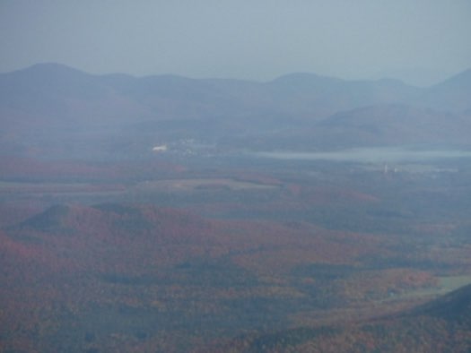
The village of Lake Placid was barely visible in the distance, due to haziness. The white building in the center is the Olympic hockey arena. Off to the right are the two ski jumps at the jumping facility.
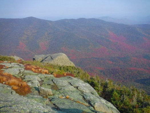
The wonderful red leaves of the temperate deciduous trees climb out of the valley onto nearby Street and Nye mountains across the valley to the northwest of the MacIntyre range.
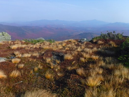
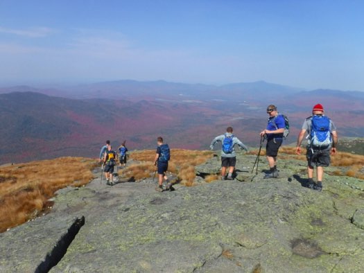
The stunted yellow grasses on the summit were somehow able to withstand the onslaught of high winds on the summit. It provided a very picturesque vista, to be sure!
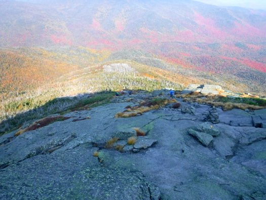
Chris, in the blue shirt, heads down the slope of Wright to get back to the main trail. The summit’s shadow still hides sunlight for much of the way.

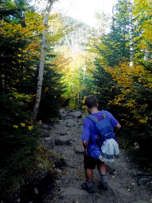
After getting back to the main trail, we turn south, and start heading up the steep ascent to Algonquin. After a few minutes of suffering, we take a break, and have a laugh or two as we compare how sweaty we are.

I sit down with them, and enjoy the sun at my back. It was a great moment to soak in the camaraderie of the group and talk about Pete’s accomplishments.
One of the big cairns near the summit, with Algonquin behind.
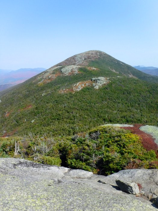
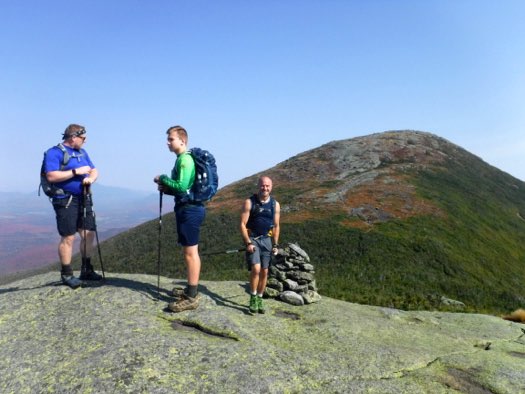
Alex and I reach the summit of New York’s 2nd-highest peak, Algonquin and savor the moment.
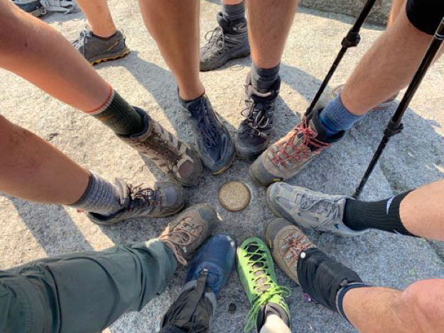
The obligatory boot photo at the Algonquin summit marker.
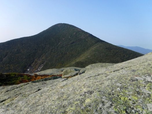
I emerge from the stunted trees near the treeline on Algonquin, Wright Peak is behind us.
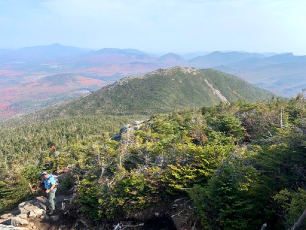
Andy, Collin and Jim on Boundary Peak, with Algonquin behind.
Alex climbs a steep section on the way to the summit of Iroquois. Boundary is on the right, and Algonquin behind, more central.
The view south from the summit of Iroquois. The dark hump on the left side is the Shepard’s Tooth on Iroquois. Beyond is Mt. Marshall, which is the southernmost and fourth mountain in the MacIntyre range. It is unfortunately separated by Cold Brook Pass, and it is almost impossible to get directly to Marshall from Iroquois, due to steep cliffs and extremely dense conifer trees. Some adventurous and/or crazy folks have successfully bushwhacked their way to Marshall this direct route, but it is my very strong opinion that using the well-established trails that go around the long way to get to Marshall instead is far safer and smarter (stepping off soap box now).
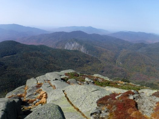
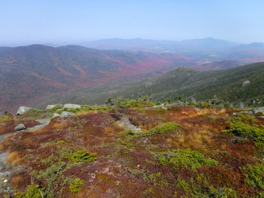
Looking southwest towards Wallface mountain from Iroquois.
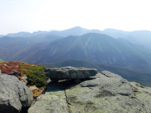
Colden and Lake Colden from Iroquois. Marcy is the highest peak in the background, with Gray peak seemingly on its’ right side shoulder, and Skylight to the right of that.
The view back to the north over Boundary to Algonquin.
The valley looking north towards distant Lake Placid.
The climb back up Algonquin was actually not as tough as it looked like it’d be. We all stop at the summit of Algonquin to eat some more food, before the loooonnnnnnggggg descent back to the trailhead.
Here we are leaving the summit of Algonquin, heading back north.
Here’s a great view of Wright Peak, and all the exposed rock we hiked up to get to the summit. Heart Lake, and our trailhead can be seen just to the left of Wright.
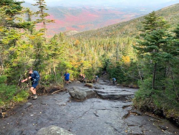
Alex descends the rock-strewn path, carefully choosing where to put each footstep. This boulder-field felt like it lasted about three miles, and made going a bit slow. You had to concentrate for fear of rolling your ankle or falling.
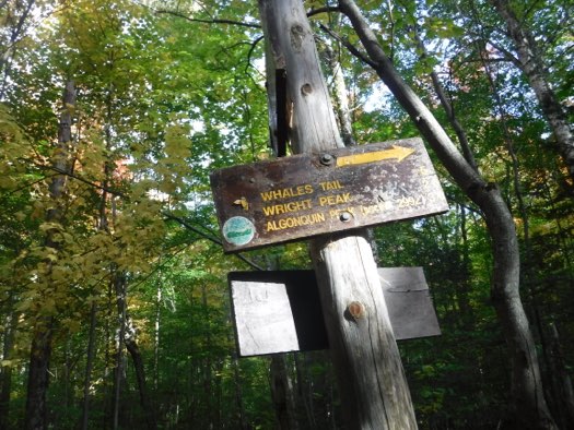
The trail sign we had been seeking for many, many miles. We were just one more mile away from the trailhead, and it was blessedly flat and easy-going from here.
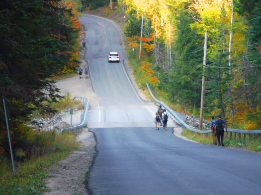
After enjoying sitting on a bench for fifteen minutes at the trailhead and resting, it was time for the final stretch, the mile-long walk back to the car along the Adirondack Loj road.
Soon, it was time to move on. Here we head down the backside (southern face) of Algonquin, towards Iroquois.
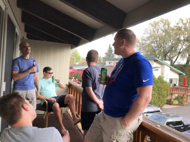
Some of us enjoy a refreshing libation after we had all cleaned up and showered after the hike.
The end.
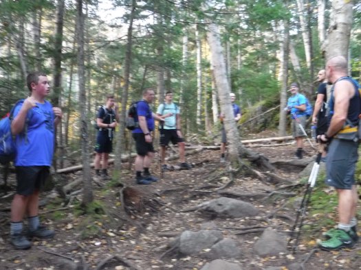
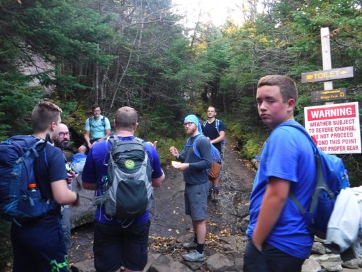
We reach the intersection for our left turn towards Wright Peak, but take a moment or two to eat some food before the push to Wright’s summit.