Whiteface, Esther

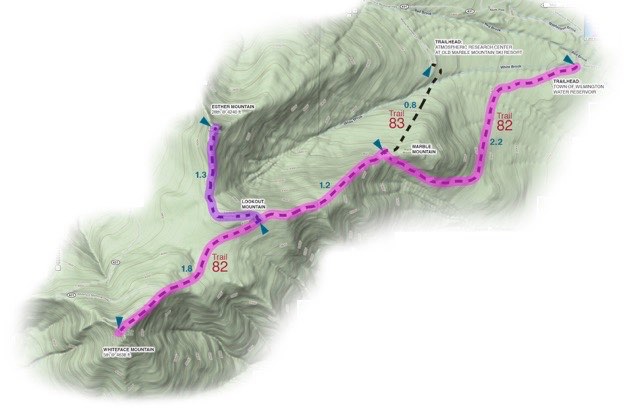
Topographic map courtesy of Topozone.com
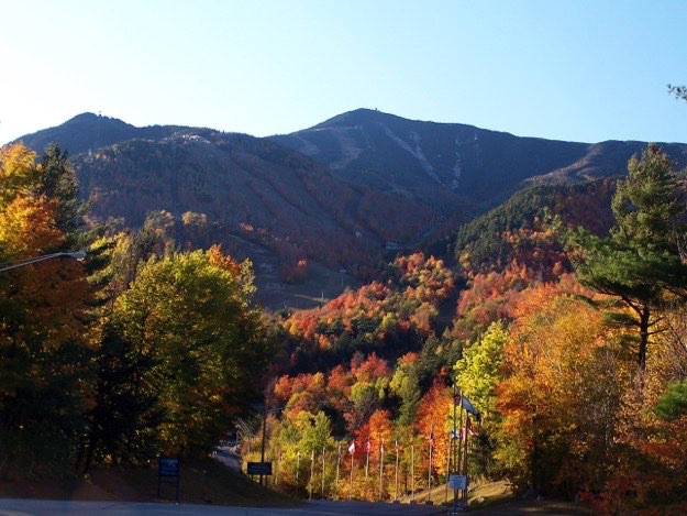
July 2009
Whiteface Mountain, as seen from the entrance to the downhill ski area


WHITEFACE
ESTHER
TRAILHEAD

Marble Mountain

Lookout Mountain
Whiteface is a mighty mountain, (5th highest in NY, at 4638 ft.), and perhaps the most unique of the 46 high peaks in New York, because it is so accessible. It offers many ways to summit it’s crowded and overpopulated peak. There are two different routes to hike up, or you can simply drive your car up the Whiteface Memorial Highway, which snakes its’ way up the Northeastern slope. It is almost all by itself, a lonely peak separated by the rest of the 46 peaks, with a world-famous ski resort on its’ eastern side. But it does have just one next-door neighbor: Esther Mountain, (28th highest at 4240 ft.).
This presented an interesting option for us. We could take it “easy”, by not having to do our normally laborious and long hike in with full packs on, camp, then do the mountain hike the next day, then hike back out on the third day.
No, this trip we seized the opportunity to get a bit more luxurious, and so we camped at the foot of the mountain, at the KOA (Kampgrounds Of America) in Wilmington. This offered nice flat tent sites, bathrooms and showers, and even a swimming pool! It also meant that we could go out for dinner in nearby Wilmington, or even Lake Placid.
So we arrived at the campgrounds on Friday afternoon, set up our tents, then went out for dinner. The 13-mile hike began at dawn the next hot morning...
(Part of my Original 46er quest)
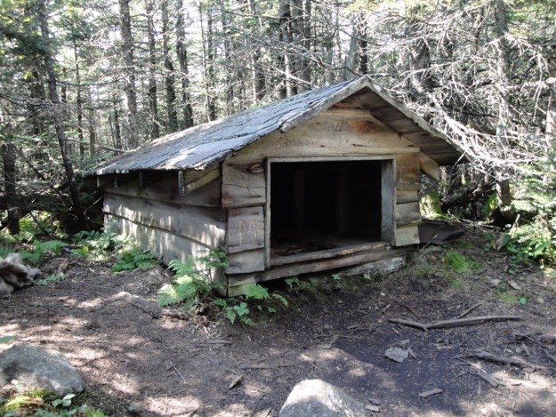
A very short shelter, most likely a home to one of those rescue sleds for the nearby ski slopes.
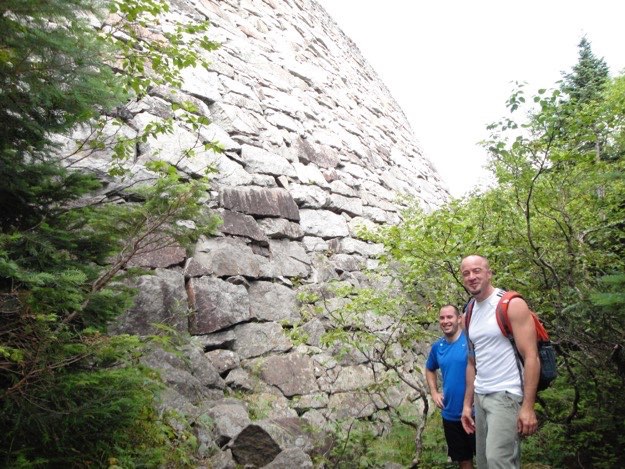
The brothers Mark and Jim taking a break at the base of the wall.
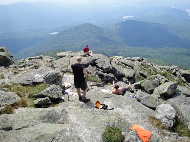
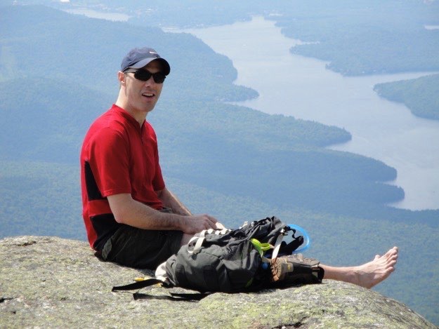
Chris enjoys lunch and give his feet a break from their socks and boots, enjoying the scenery of Lake Placid.
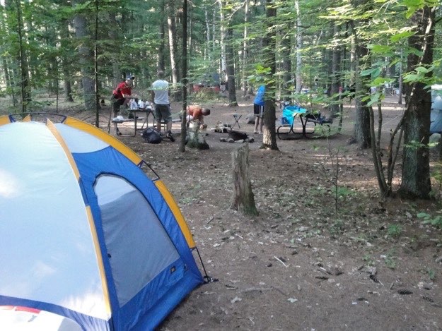
Friday – the KOA Kampground in Wilmington
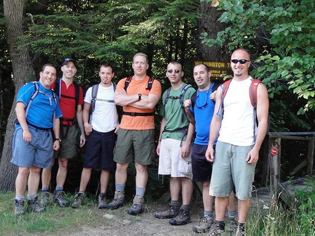
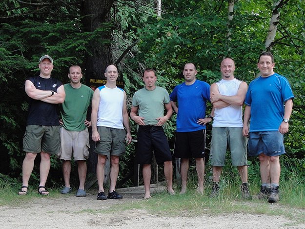
The guys at the Wilmington trailhead parking lot to the north.
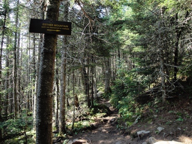
At 3.4 miles in, we see the turnoff to the right for Esther Mountain. We would do that on the way down from Whiteface, later in the day. There’s also a big cairn of rocks here, so you can’t possibly miss the turn.
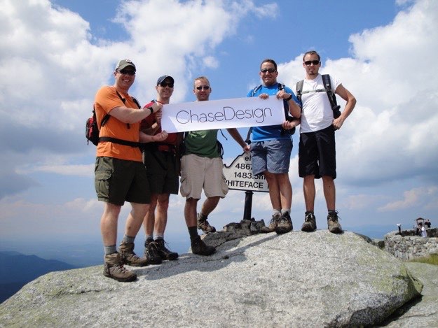
The boys from ChaseDesign get their photo op.
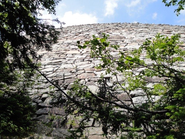
Eventually, we emerge through the trees to a massive rock wall. This photo looks up the wall, to the sky. This is the side of the Whiteface Veteran’s Memorial Highway, a true engineering feat of a road, that snakes its’ way up the back side of Whiteface, allowing visitors who don’t wish to hike up a mountain, still get an idea what it is like to be on top of one of the Adirondack mountains.
Mark and Jonathan with Little Whiteface in the middle distance.
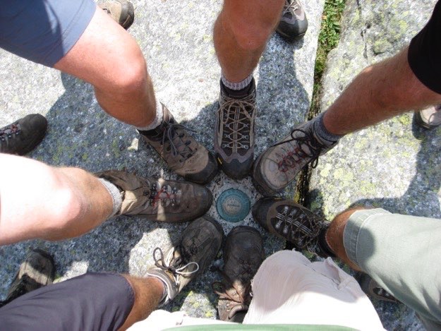
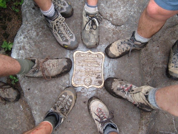
The obligatory boot photo with the plaque.
Back at camp, Mark puts on some second skin atop some tender heel blisters.
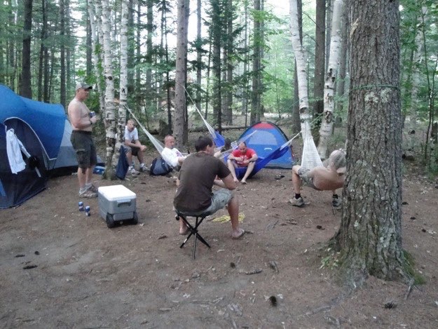
Hanging out at camp, before heading into Lake Placid for a massive steak dinner at the Lake Placid Brewery.
It turns out a bunch of sweaty hikers can actually clean up real nice! Having earned the reward of a few beers, we’re off to the brewery.
We set up our little tent city in the wide open, yet fully shaded campsites of the KOA. Finding a flat spot for our tents was comparatively easy on this trip. We HIGHLY recommend this wonderful campground.
Saturday – The peak hike – 13 miles
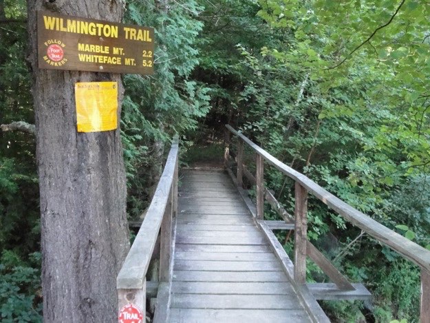
The bridge of Khazad-dum! Not really; just a footbridge crossing a small brook...
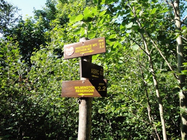
After a particularly steep and difficult climb up the side of the Old Marble Mountain ski area (long since closed), we see this sign. We came from the left, and are heading to the right. Another 3 miles to Whiteface.
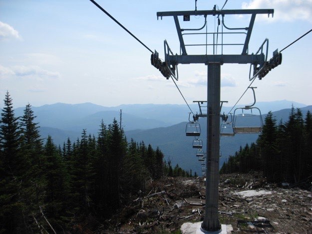
We come across a strange sight for one of our hikes: a newly-constructed triple chairlift that goes to Lookout Mountain, an intermediate peak on the northern end of Whiteface ski resort.
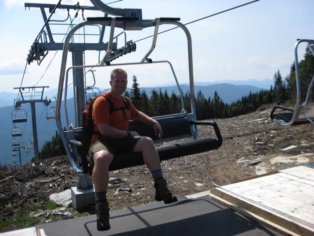
This provides Andy a nice spot to rest! Too bad we couldn’t have taken this chairlift up, (and have it count)...
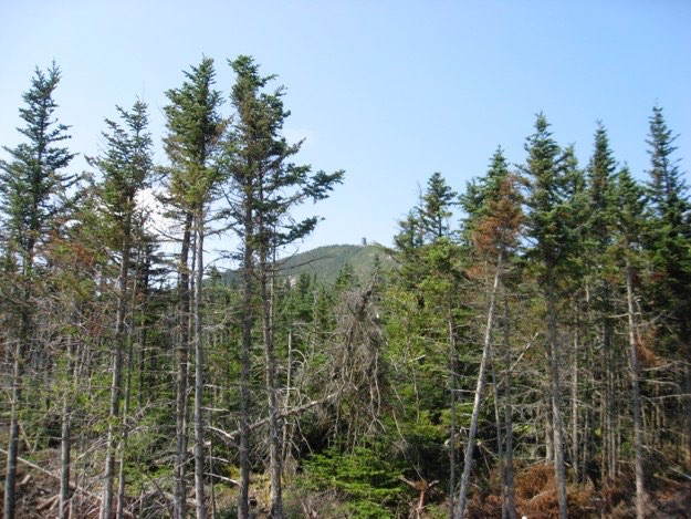
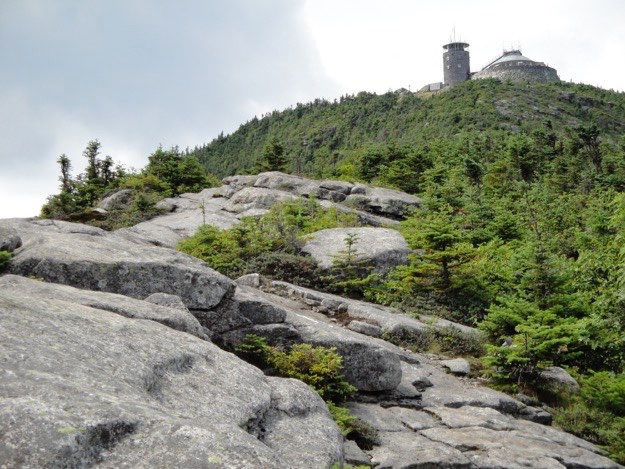
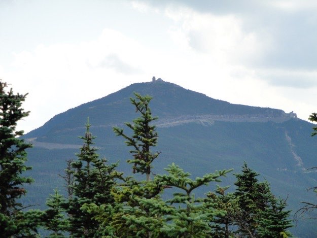
Through the trees, we catch a glimpse of Whiteface’s summit, with the weather observatory tower.
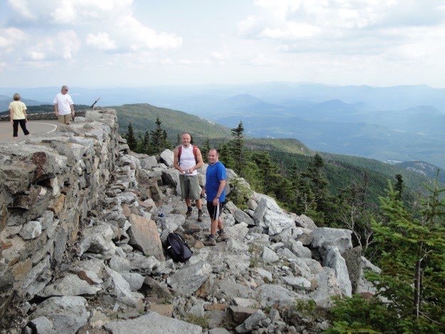
The trail climbs up the rocks alongside the road, (and curious onlookers), and eventually meets up with the road. Here, Jim and Mark enjoy the amazing views that have opened up.
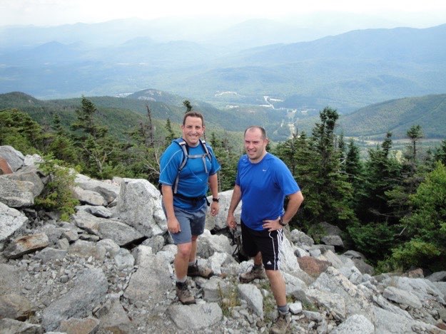
Mark and I with the ski slopes behind us, to the east.
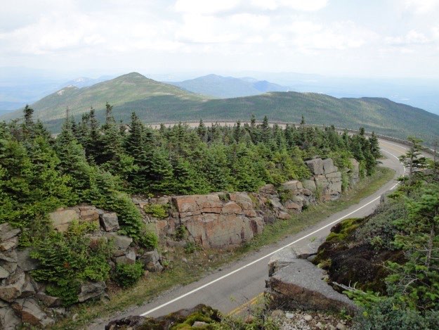
The trail continues south, along the outside of the rock wall. When we get to the rock cliff on the left, we’ll have to climb that.
The short climb up that rock cliff reveals the road and the way we took here. The darker cloud-covered ridgeline starting on the right side of the photo is the way we took. The sunlit peak to the left is Esther, where we’ll go later, after tackling Whiteface.
The summit of Whiteface is so close now!
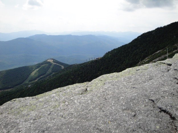
Walking precariously atop the thin knife-like ridge to the summit. You can see the ski slopes in the bowl off to the left, with ski trails spreading out from Little Whiteface, with the distant, hazy high peaks way off in the distance.
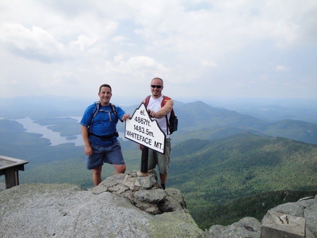
We made it! I stand with Jim at the lookout towards Lake Placid.
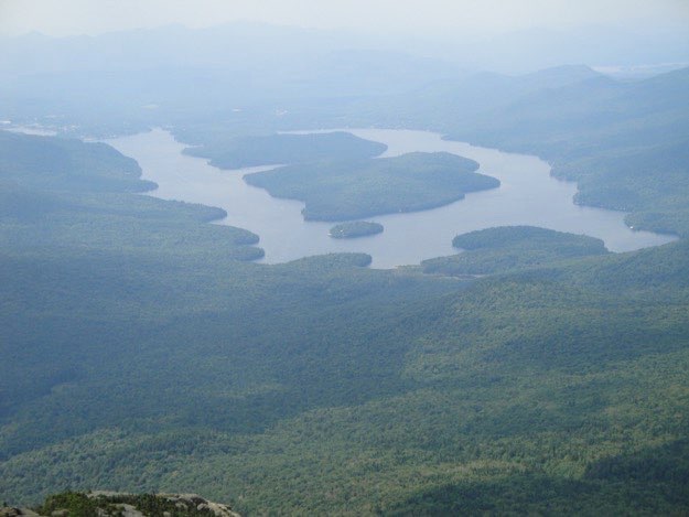
A zoomed-in view of uniquely-shaped Lake Placid. The village and Mirror Lake are off to the extreme left.
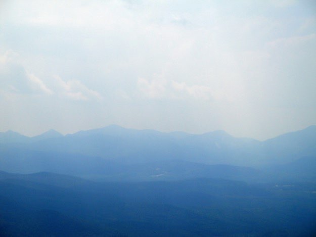
Unfortunately, it was simply too hot and hazy to get a crisp and clean view of the other high peaks. In the distance, from left to right are: Basin, Haystack Marcy, Gray, Skylight, Colden and Algonquin.
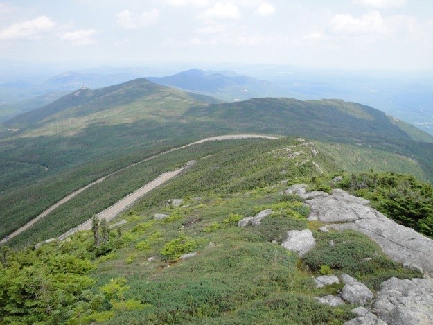
The view north again, Esther to the left, Lookout and Marble to the right, with the roadway snaking off to the left.
The guys find an unpopulated area on the south face of the summit to rest, eat lunch and enjoy the views.
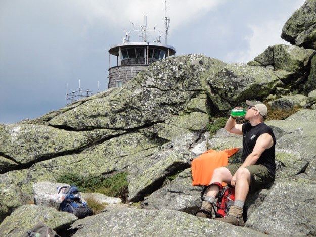
Andy rehydrates with the weather observatory tower in the background.
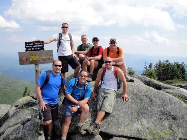
All the guys on the actual summit of Whiteface.
The obligatory boot shot with the summit marker, then we head back down to tackle Esther next...
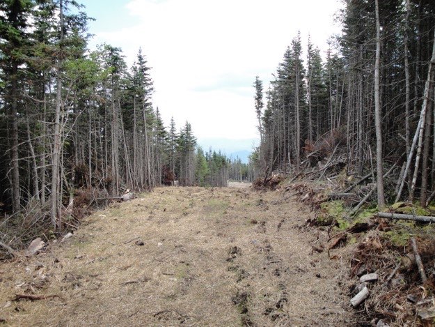
Back the way we came. Here is the new ski trail atop Lookout Mountain.
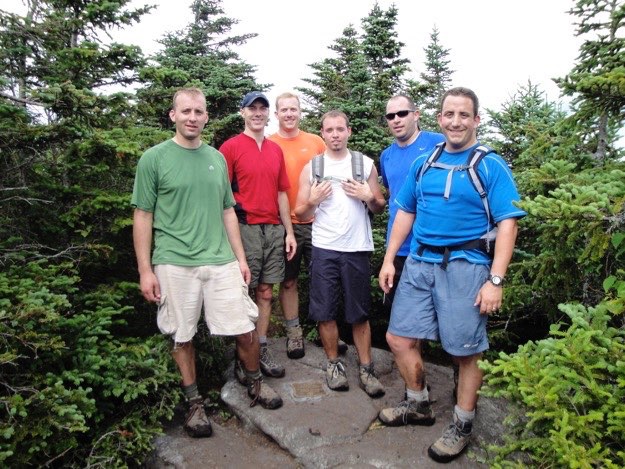
The guys atop Esther’s boulder of a summit, (minus the photographer, Jim)
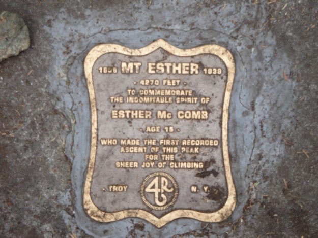
The plaque.
The view back towards Whiteface from Esther. Notice the rock walls of the Veteran’s Memorial Highway and the “Castle” structure to the far right.
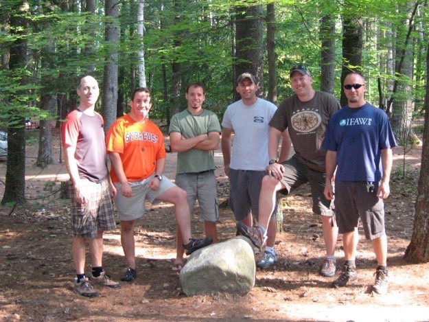
The tired crew, successfully back at the trailhead again.
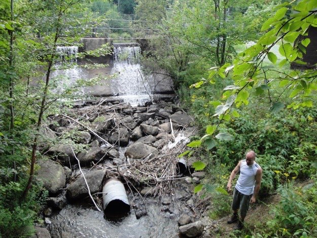
Jim goes down to the brook to cool off before we head back to the KOA.
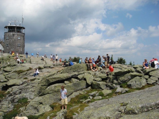
The summit is crowded with people who drove up the mountain.